
 Mikhaylovka
Dyrestuy
Mikhaylovka
Mayskiy
Novobessergenevka
Tersky District
Lesnoy
Tertezh
Kuz'minskiye Otverzhki
Mikhaylovka
Dyrestuy
Mikhaylovka
Mayskiy
Novobessergenevka
Tersky District
Lesnoy
Tertezh
Kuz'minskiye Otverzhki
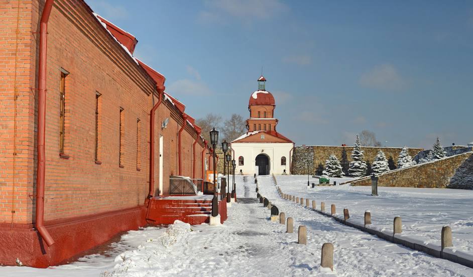
Kuznetsk fortress on the map, Novokuznetsk, Russian Federation
Photo
Where is located Kuznetsk fortress
Kuznetsk fortress — local attraction, which is located at Krepostnoy Proyezd, 1, Novokuznetsk, Kemerovo Oblast, 654034 and belongs to the category — fortress. Average visitor rating for this place — 4.6 (according to 1183 ratings, information from open sources and relevant for 2022).
Exact location — Kuznetsk fortress, marked on the map with a red marker.
You can get directions to Kuznetsk fortress on the map from your location.
What else is interesting in Novokuznetsk? You can see all the sights if you go to the city page.
Coordinates
Kuznetsk fortress, Russian Federation coordinates in decimal format: latitude — 53.77442002916959, longitude — 87.18267069837954. When converted to degrees, minutes, seconds Kuznetsk fortress has the following coordinates: 53°46′27.91 north latitude and 87°10′57.61 east longitude.
Nearby cities
The largest cities that are located nearby:
- Prokopyevsk — 30 km
- Mezhdurechensk — 61 km
- Leninsk-Kuznetskiy — 117 km
- Biysk — 187 km
- Barnaul — 226 km
- Abakan — 281 km
- Novosibirsk — 299 km
- Tomsk — 330 km
- Seversk — 343 km
- Achinsk — 345 km
- Krasnoyarsk — 435 km
- Rubtsovsk — 477 km
- Oskemen
 (Kazakhstan) — 528 km
 - Kyzyl — 550 km
- Kansk — 594 km
- Semey (Kazakhstan) — 609 km
- Altay
 (China) — 658 km
 - Pavlodar (Kazakhstan) — 706 km
- Ekibastuz (Kazakhstan) — 839 km
Distance to the capital
Distance to the capital (Moscow) is about — 3120 km.