
 Mikhaylovka
Dyrestuy
Mikhaylovka
Mayskiy
Novobessergenevka
Tersky District
Lesnoy
Tertezh
Kuz'minskiye Otverzhki
Mikhaylovka
Dyrestuy
Mikhaylovka
Mayskiy
Novobessergenevka
Tersky District
Lesnoy
Tertezh
Kuz'minskiye Otverzhki
Ryazanskiy Gosudarstvennyy Oblastnoy Khudozhestvennyy Muzey Im. I.pozhalostina on the map, Ryazan, Russian Federation
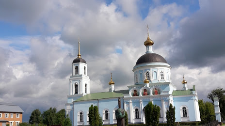
Photo
Where is located Ryazanskiy Gosudarstvennyy Oblastnoy Khudozhestvennyy Muzey Im. I.pozhalostina
Ryazanskiy Gosudarstvennyy Oblastnoy Khudozhestvennyy Muzey Im. I.pozhalostina — local attraction, which is located at Ulitsa Poryadok, 76, Ryazan, Ryazan Oblast, 390021 and belongs to the category — museum. Average visitor rating for this place — 4.1 (according to 15 ratings, information from open sources and relevant for 2022).
Exact location — Ryazanskiy Gosudarstvennyy Oblastnoy Khudozhestvennyy Muzey Im. I.pozhalostina, marked on the map with a red marker.
You can get directions to Ryazanskiy Gosudarstvennyy Oblastnoy Khudozhestvennyy Muzey Im. I.pozhalostina on the map from your location.
What else is interesting in Ryazan? You can see all the sights if you go to the city page.
Coordinates
Ryazanskiy Gosudarstvennyy Oblastnoy Khudozhestvennyy Muzey Im. I.pozhalostina, Russian Federation coordinates in decimal format: latitude — 54.798554820287755, longitude — 39.83840909841863. When converted to degrees, minutes, seconds Ryazanskiy Gosudarstvennyy Oblastnoy Khudozhestvennyy Muzey Im. I.pozhalostina has the following coordinates: 54°47′54.8 north latitude and 39°50′18.27 east longitude.
Nearby cities
The largest cities that are located nearby:
- Kolomna — 80 km
- Novomoskovsk — 113 km
- Orekhovo-Zuyevo — 140 km
- Tula — 143 km
- Serpukhov — 149 km
- Elektrostal — 151 km
- Noginsk — 160 km
- Podolsk — 164 km
- Lyubertsy — 164 km
- Izmaylovo — 167 km
- Balashikha — 172 km
- Vladimir — 175 km
- Murom — 180 km
- Odintsovo — 192 km
- Pushkino — 193 km
- Khimki — 200 km
- Obninsk — 205 km
- Kovrov — 218 km
- Zelenograd — 219 km
Distance to the capital
Distance to the capital (Moscow) is about — 176 km.