
 Mikhaylovka
Dyrestuy
Mikhaylovka
Mayskiy
Novobessergenevka
Tersky District
Lesnoy
Tertezh
Kuz'minskiye Otverzhki
Mikhaylovka
Dyrestuy
Mikhaylovka
Mayskiy
Novobessergenevka
Tersky District
Lesnoy
Tertezh
Kuz'minskiye Otverzhki
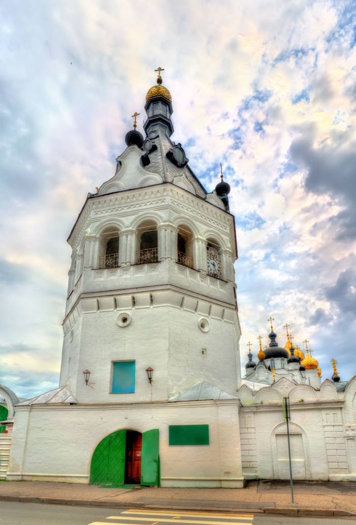
Bogoyavlenskiy-Anastasiin Zhenskiy Monastyr' on the map, Kostroma, Russian Federation
Photo
Where is located Bogoyavlenskiy-Anastasiin Zhenskiy Monastyr'
Bogoyavlenskiy-Anastasiin Zhenskiy Monastyr' — local attraction, which is located at Ulitsa Simanovskogo, 26, Kostroma, Kostroma Oblast, 156000 and belongs to the category — convent. Average visitor rating for this place — 4.8 (according to 1257 ratings, information from open sources and relevant for 2022).
Exact location — Bogoyavlenskiy-Anastasiin Zhenskiy Monastyr', marked on the map with a red marker.
You can get directions to Bogoyavlenskiy-Anastasiin Zhenskiy Monastyr' on the map from your location.
What else is interesting in Kostroma? You can see all the sights if you go to the city page.
Coordinates
Bogoyavlenskiy-Anastasiin Zhenskiy Monastyr', Russian Federation coordinates in decimal format: latitude — 57.77315053419399, longitude — 40.92416379853486. When converted to degrees, minutes, seconds Bogoyavlenskiy-Anastasiin Zhenskiy Monastyr' has the following coordinates: 57°46′23.34 north latitude and 40°55′26.99 east longitude.
Nearby cities
The largest cities that are located nearby:
- Yaroslavl — 64 km
- Rybinsk — 127 km
- Kovrov — 157 km
- Vologda — 171 km
- Vladimir — 182 km
- Cherepovets — 229 km
- Dzerzhinsk — 229 km
- Orekhovo-Zuyevo — 249 km
- Murom — 253 km
- Noginsk — 259 km
- Elektrostal — 268 km
- Pushkino — 274 km
- Balashikha — 284 km
- Lyubertsy — 298 km
- Khimki — 299 km
- Zelenograd — 303 km
- Arzamas — 318 km
- Izmaylovo — 319 km
- Tver — 319 km
Distance to the capital
Distance to the capital (Moscow) is about — 302 km.