
 Mikhaylovka
Dyrestuy
Mikhaylovka
Mayskiy
Novobessergenevka
Tersky District
Lesnoy
Tertezh
Kuz'minskiye Otverzhki
Mikhaylovka
Dyrestuy
Mikhaylovka
Mayskiy
Novobessergenevka
Tersky District
Lesnoy
Tertezh
Kuz'minskiye Otverzhki
Muzey Yoshkina Kota on the map, Yoshkar-Ola, Russian Federation
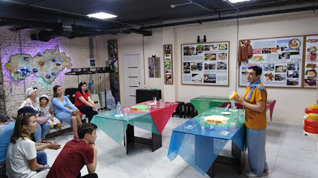
Photo
Where is located Muzey Yoshkina Kota
Muzey Yoshkina Kota — local attraction, which is located at Ploshchad' Revolyutsii, 3, Yoshkar-Ola, Mari El Republic, 424000 and belongs to the category — museum. Average visitor rating for this place — 3.0 (according to 4 ratings, information from open sources and relevant for 2022).
Exact location — Muzey Yoshkina Kota, marked on the map with a red marker.
You can get directions to Muzey Yoshkina Kota on the map from your location.
What else is interesting in Yoshkar-Ola? You can see all the sights if you go to the city page.
Coordinates
Muzey Yoshkina Kota, Russian Federation coordinates in decimal format: latitude — 56.636723637524355, longitude — 47.90001299848998. When converted to degrees, minutes, seconds Muzey Yoshkina Kota has the following coordinates: 56°38′12.21 north latitude and 47°54′0.05 east longitude.
Nearby cities
The largest cities that are located nearby:
- Novocheboksarsk — 63 km
- Cheboksary — 66 km
- Zelenodolsk — 96 km
- Kazan — 122 km
- Kirov — 241 km
- Ulyanovsk — 258 km
- Nizhnekamsk — 270 km
- Dzerzhinsk — 275 km
- Dimitrovgrad — 288 km
- Arzamas — 289 km
- Saransk — 322 km
- Izhevsk — 322 km
- Glazov — 326 km
- Almetyevsk — 342 km
- Tolyatti — 360 km
- Sarapul — 363 km
- Murom — 383 km
- Syzran — 385 km
- Neftekamsk — 400 km
Distance to the capital
Distance to the capital (Moscow) is about — 643 km.