
 Mikhaylovka
Dyrestuy
Mikhaylovka
Mayskiy
Novobessergenevka
Tersky District
Lesnoy
Tertezh
Kuz'minskiye Otverzhki
Mikhaylovka
Dyrestuy
Mikhaylovka
Mayskiy
Novobessergenevka
Tersky District
Lesnoy
Tertezh
Kuz'minskiye Otverzhki
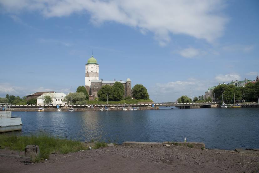
Vyborgskiy Zaliv on the map, Vyborg, Russian Federation
Photo
Where is located Vyborgskiy Zaliv
Vyborgskiy Zaliv — local attraction, which is located at Shkol'nyy and belongs to the category — -. Average visitor rating for this place — 4.7 (according to 332 ratings, information from open sources and relevant for 2022).
Exact location — Vyborgskiy Zaliv, marked on the map with a red marker.
You can get directions to Vyborgskiy Zaliv on the map from your location.
What else is interesting in Vyborg? You can see all the sights if you go to the city page.
Coordinates
Vyborgskiy Zaliv, Russian Federation coordinates in decimal format: latitude — 60.72250374151655, longitude — 28.708013836773958. When converted to degrees, minutes, seconds Vyborgskiy Zaliv has the following coordinates: 60°43′21.01 north latitude and 28°42′28.85 east longitude.
Nearby cities
The largest cities that are located nearby:
- Saint Petersburg — 123 km
- Kolpino — 149 km
- Vantaa
 (Finland) — 209 km
 - Helsinki (Finland) — 218 km
- Espoo (Finland) — 232 km
- Tallinn
 (Estonia) — 266 km
 - Tampere (Finland) — 278 km
- Tartu (Estonia) — 284 km
- Petrozavodsk — 315 km
- Pskov — 321 km
- Turku (Finland) — 355 km
- Velikiye Luki — 496 km
- Oulu (Finland) — 499 km
- Rīga
 (Latvia) — 502 km
 - Cherepovets — 548 km
- Daugavpils (Latvia) — 552 km
- Navapolatsk
 (Belarus) — 575 km
 - Tver — 607 km
- Panevėžys
 (Lithuania) — 615 km
Distance to the capital
Distance to the capital (Moscow) is about — 759 km.