
 Mikhaylovka
Dyrestuy
Mikhaylovka
Mayskiy
Novobessergenevka
Tersky District
Lesnoy
Tertezh
Kuz'minskiye Otverzhki
Mikhaylovka
Dyrestuy
Mikhaylovka
Mayskiy
Novobessergenevka
Tersky District
Lesnoy
Tertezh
Kuz'minskiye Otverzhki
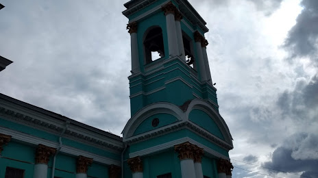
Znamenskiy Kafedral'nyy Sobor on the map, Kursk, Russian Federation
Photo
Where is located Znamenskiy Kafedral'nyy Sobor
Znamenskiy Kafedral'nyy Sobor — local attraction, which is located at Ulitsa Lunacharskogo, 4, Kursk, Kursk Oblast, 305000 and belongs to the category — cathedral. Average visitor rating for this place — 4.8 (according to 609 ratings, information from open sources and relevant for 2022).
Exact location — Znamenskiy Kafedral'nyy Sobor, marked on the map with a red marker.
You can get directions to Znamenskiy Kafedral'nyy Sobor on the map from your location.
What else is interesting in Kursk? You can see all the sights if you go to the city page.
Coordinates
Znamenskiy Kafedral'nyy Sobor, Russian Federation coordinates in decimal format: latitude — 51.727811847304714, longitude — 36.19250919830301. When converted to degrees, minutes, seconds Znamenskiy Kafedral'nyy Sobor has the following coordinates: 51°43′40.12 north latitude and 36°11′33.03 east longitude.
Nearby cities
The largest cities that are located nearby:
- Belgorod — 127 km
- Sumy
 (Ukraine) — 130 km
 - Yelets — 187 km
- Bryansk — 207 km
- Voronezh — 209 km
- Lipetsk — 252 km
- Poltava (Ukraine) — 261 km
- Novomoskovsk — 290 km
- Tula — 292 km
- Kaluga — 314 km
- Chernihiv (Ukraine) — 336 km
- Kremenchuk (Ukraine) — 354 km
- Pavlohrad (Ukraine) — 354 km
- Gomel
 (Belarus) — 358 km
 - Serpukhov — 364 km
- Dniprodzerzhyns'k (Ukraine) — 370 km
- Tambov — 371 km
- Obninsk — 378 km
- Cherkasy (Ukraine) — 387 km
Distance to the capital
Distance to the capital (Moscow) is about — 458 km.