
 Mikhaylovka
Dyrestuy
Mikhaylovka
Mayskiy
Novobessergenevka
Tersky District
Lesnoy
Tertezh
Kuz'minskiye Otverzhki
Mikhaylovka
Dyrestuy
Mikhaylovka
Mayskiy
Novobessergenevka
Tersky District
Lesnoy
Tertezh
Kuz'minskiye Otverzhki
Sergiyevo-Kazanskiy Kafedral'nyy Sobor on the map, Kursk, Russian Federation
Photo
Where is located Sergiyevo-Kazanskiy Kafedral'nyy Sobor
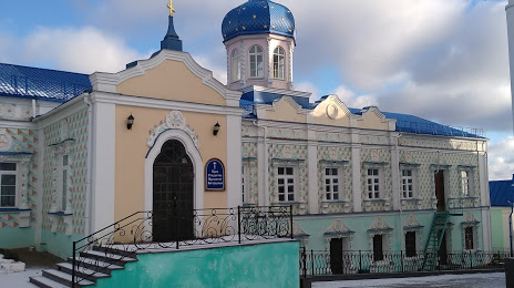
Sergiyevo-Kazanskiy Kafedral'nyy Sobor — local attraction, which is located at Ulitsa Maksima Gor'kogo, 27, Kursk, Kursk Oblast, 305000 and belongs to the category — cathedral. Average visitor rating for this place — 4.9 (according to 324 ratings, information from open sources and relevant for 2022).
Exact location — Sergiyevo-Kazanskiy Kafedral'nyy Sobor, marked on the map with a red marker.
You can get directions to Sergiyevo-Kazanskiy Kafedral'nyy Sobor on the map from your location.
What else is interesting in Kursk? You can see all the sights if you go to the city page.
Coordinates
Sergiyevo-Kazanskiy Kafedral'nyy Sobor, Russian Federation coordinates in decimal format: latitude — 51.73562312031891, longitude — 36.19658589830339. When converted to degrees, minutes, seconds Sergiyevo-Kazanskiy Kafedral'nyy Sobor has the following coordinates: 51°44′8.24 north latitude and 36°11′47.71 east longitude.
Nearby cities
The largest cities that are located nearby:
- Belgorod — 127 km
- Sumy
 (Ukraine) — 130 km
 - Yelets — 187 km
- Bryansk — 207 km
- Voronezh — 209 km
- Lipetsk — 252 km
- Poltava (Ukraine) — 261 km
- Novomoskovsk — 290 km
- Tula — 292 km
- Kaluga — 314 km
- Chernihiv (Ukraine) — 336 km
- Kremenchuk (Ukraine) — 354 km
- Pavlohrad (Ukraine) — 354 km
- Gomel
 (Belarus) — 358 km
 - Serpukhov — 364 km
- Dniprodzerzhyns'k (Ukraine) — 370 km
- Tambov — 371 km
- Obninsk — 378 km
- Cherkasy (Ukraine) — 387 km
Distance to the capital
Distance to the capital (Moscow) is about — 457 km.