
 Mikhaylovka
Dyrestuy
Mikhaylovka
Mayskiy
Novobessergenevka
Tersky District
Lesnoy
Tertezh
Kuz'minskiye Otverzhki
Mikhaylovka
Dyrestuy
Mikhaylovka
Mayskiy
Novobessergenevka
Tersky District
Lesnoy
Tertezh
Kuz'minskiye Otverzhki
Ozero Ogublyanka on the map, Obninsk, Russian Federation
Photo
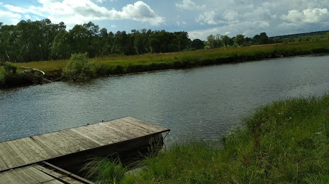
Where is located Ozero Ogublyanka
Ozero Ogublyanka — local attraction, which is located at no data and belongs to the category — -. Average visitor rating for this place — 4.3 (according to 39 ratings, information from open sources and relevant for 2022).
Exact location — Ozero Ogublyanka, marked on the map with a red marker.
You can get directions to Ozero Ogublyanka on the map from your location.
What else is interesting in Obninsk? You can see all the sights if you go to the city page.
Coordinates
Ozero Ogublyanka, Russian Federation coordinates in decimal format: latitude — 55.011644839762894, longitude — 36.702357451302944. When converted to degrees, minutes, seconds Ozero Ogublyanka has the following coordinates: 55°0′41.92 north latitude and 36°42′8.49 east longitude.
Nearby cities
The largest cities that are located nearby:
- Serpukhov — 57 km
- Kaluga — 66 km
- Podolsk — 69 km
- Odintsovo — 74 km
- Izmaylovo — 82 km
- Khimki — 101 km
- Lyubertsy — 103 km
- Zelenograd — 104 km
- Balashikha — 115 km
- Tula — 121 km
- Pushkino — 124 km
- Kolomna — 137 km
- Elektrostal — 138 km
- Noginsk — 143 km
- Novomoskovsk — 165 km
- Orekhovo-Zuyevo — 166 km
- Tver — 197 km
- Ryazan — 207 km
- Bryansk — 251 km
Distance to the capital
Distance to the capital (Moscow) is about — 101 km.