
 Mikhaylovka
Dyrestuy
Mikhaylovka
Mayskiy
Novobessergenevka
Tersky District
Lesnoy
Tertezh
Kuz'minskiye Otverzhki
Mikhaylovka
Dyrestuy
Mikhaylovka
Mayskiy
Novobessergenevka
Tersky District
Lesnoy
Tertezh
Kuz'minskiye Otverzhki
Uspenskiy Sobor on the map, Biysk, Russian Federation
Photo
Where is located Uspenskiy Sobor
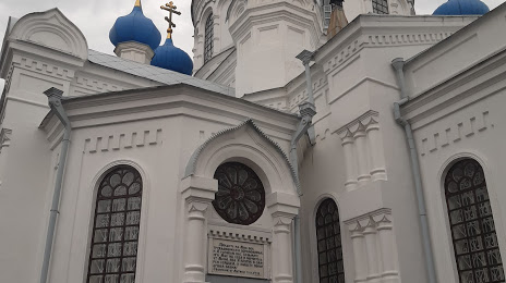
Uspenskiy Sobor — local attraction, which is located at Ulitsa Sovetskaya, 13, Biysk, Altai Krai, 659300 and belongs to the category — church. Average visitor rating for this place — 4.8 (according to 264 ratings, information from open sources and relevant for 2022).
Exact location — Uspenskiy Sobor, marked on the map with a red marker.
You can get directions to Uspenskiy Sobor on the map from your location.
What else is interesting in Biysk? You can see all the sights if you go to the city page.
Coordinates
Uspenskiy Sobor, Russian Federation coordinates in decimal format: latitude — 52.544500010269545, longitude — 85.23222719833332. When converted to degrees, minutes, seconds Uspenskiy Sobor has the following coordinates: 52°32′40.2 north latitude and 85°13′56.02 east longitude.
Nearby cities
The largest cities that are located nearby:
- Barnaul — 132 km
- Prokopyevsk — 178 km
- Novokuznetsk — 184 km
- Mezhdurechensk — 225 km
- Leninsk-Kuznetskiy — 243 km
- Rubtsovsk — 298 km
- Novosibirsk — 310 km
- Oskemen
 (Kazakhstan) — 339 km
 - Semey (Kazakhstan) — 420 km
- Abakan — 426 km
- Tomsk — 439 km
- Seversk — 450 km
- Achinsk — 524 km
- Pavlodar (Kazakhstan) — 559 km
- Altay
 (China) — 562 km
 - Krasnoyarsk — 611 km
- Kyzyl — 639 km
- Ekibastuz (Kazakhstan) — 684 km
- Kansk — 763 km
Distance to the capital
Distance to the capital (Moscow) is about — 3060 km.