
 Mikhaylovka
Dyrestuy
Mikhaylovka
Mayskiy
Novobessergenevka
Tersky District
Lesnoy
Tertezh
Kuz'minskiye Otverzhki
Mikhaylovka
Dyrestuy
Mikhaylovka
Mayskiy
Novobessergenevka
Tersky District
Lesnoy
Tertezh
Kuz'minskiye Otverzhki
Gorodskoye Ozero on the map, Almetyevsk, Russian Federation
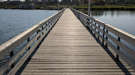
Photo
Where is located Gorodskoye Ozero
Gorodskoye Ozero — local attraction, which is located at no data and belongs to the category — -. Average visitor rating for this place — 4.4 (according to 48 ratings, information from open sources and relevant for 2022).
Exact location — Gorodskoye Ozero, marked on the map with a red marker.
You can get directions to Gorodskoye Ozero on the map from your location.
What else is interesting in Almetyevsk? You can see all the sights if you go to the city page.
Coordinates
Gorodskoye Ozero, Russian Federation coordinates in decimal format: latitude — 54.89191416761806, longitude — 52.279015943436626. When converted to degrees, minutes, seconds Gorodskoye Ozero has the following coordinates: 54°53′30.89 north latitude and 52°16′44.46 east longitude.
Nearby cities
The largest cities that are located nearby:
- Nizhnekamsk — 88 km
- Neftekamsk — 181 km
- Dimitrovgrad — 192 km
- Sarapul — 196 km
- Izhevsk — 221 km
- Kazan — 221 km
- Ufa — 234 km
- Samara — 236 km
- Tolyatti — 244 km
- Novokuybyshevsk — 254 km
- Zelenodolsk — 259 km
- Ulyanovsk — 263 km
- Sterlitamak — 276 km
- Salavat — 292 km
- Syzran — 319 km
- Novocheboksarsk — 325 km
- Yoshkar-Ola — 332 km
- Cheboksary — 343 km
- Glazov — 359 km
Distance to the capital
Distance to the capital (Moscow) is about — 931 km.