
 Mikhaylovka
Dyrestuy
Mikhaylovka
Mayskiy
Novobessergenevka
Tersky District
Lesnoy
Tertezh
Kuz'minskiye Otverzhki
Mikhaylovka
Dyrestuy
Mikhaylovka
Mayskiy
Novobessergenevka
Tersky District
Lesnoy
Tertezh
Kuz'minskiye Otverzhki
Kurskoye Vodokhranilishche on the map, Kurchatov, Russian Federation
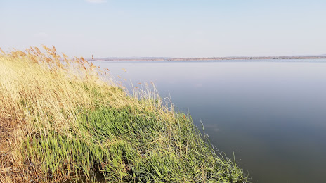
Photo
Where is located Kurskoye Vodokhranilishche
Kurskoye Vodokhranilishche — local attraction, which is located at 21.5 km² and belongs to the category — -. Average visitor rating for this place — 4.5 (according to 119 ratings, information from open sources and relevant for 2022).
Exact location — Kurskoye Vodokhranilishche, marked on the map with a red marker.
You can get directions to Kurskoye Vodokhranilishche on the map from your location.
What else is interesting in Kurchatov? You can see all the sights if you go to the city page.
Coordinates
Kurskoye Vodokhranilishche, Russian Federation coordinates in decimal format: latitude — 51.674159907848775, longitude — 35.676987200436145. When converted to degrees, minutes, seconds Kurskoye Vodokhranilishche has the following coordinates: 51°40′26.98 north latitude and 35°40′37.15 east longitude.
Nearby cities
The largest cities that are located nearby:
- Kursk — 33 km
- Sumy
 (Ukraine) — 103 km
 - Belgorod — 134 km
- Bryansk — 196 km
- Yelets — 217 km
- Voronezh — 242 km
- Poltava (Ukraine) — 243 km
- Lipetsk — 284 km
- Chernihiv (Ukraine) — 303 km
- Tula — 308 km
- Novomoskovsk — 311 km
- Kaluga — 322 km
- Gomel
 (Belarus) — 328 km
 - Kremenchuk (Ukraine) — 330 km
- Pavlohrad (Ukraine) — 347 km
- Dniprodzerzhyns'k (Ukraine) — 355 km
- Cherkasy (Ukraine) — 357 km
- Serpukhov — 377 km
- Kyiv (Ukraine) — 387 km
Distance to the capital
Distance to the capital (Moscow) is about — 472 km.