
 Mikhaylovka
Dyrestuy
Mikhaylovka
Mayskiy
Novobessergenevka
Tersky District
Lesnoy
Tertezh
Kuz'minskiye Otverzhki
Mikhaylovka
Dyrestuy
Mikhaylovka
Mayskiy
Novobessergenevka
Tersky District
Lesnoy
Tertezh
Kuz'minskiye Otverzhki
Kudma River on the map, Kstovo, Russian Federation
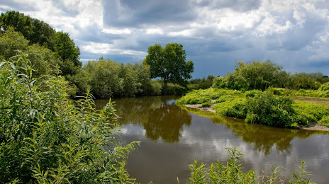
Photo
Where is located Kudma River
Kudma River — local attraction, which is located at Volga→ Caspian Sea and belongs to the category — -. Average visitor rating for this place — 4.4 (according to 176 ratings, information from open sources and relevant for 2022).
Exact location — Kudma River, marked on the map with a red marker.
You can get directions to Kudma River on the map from your location.
What else is interesting in Kstovo? You can see all the sights if you go to the city page.
Coordinates
Kudma River, Russian Federation coordinates in decimal format: latitude — 56.144574832976645, longitude — 44.16608797796564. When converted to degrees, minutes, seconds Kudma River has the following coordinates: 56°8′40.47 north latitude and 44°9′57.92 east longitude.
Nearby cities
The largest cities that are located nearby:
- Dzerzhinsk — 45 km
- Arzamas — 88 km
- Murom — 149 km
- Kovrov — 175 km
- Cheboksary — 189 km
- Novocheboksarsk — 206 km
- Saransk — 229 km
- Yoshkar-Ola — 231 km
- Vladimir — 231 km
- Kostroma — 260 km
- Zelenodolsk — 272 km
- Yaroslavl — 301 km
- Kazan — 312 km
- Orekhovo-Zuyevo — 326 km
- Penza — 333 km
- Ryazan — 333 km
- Ulyanovsk — 339 km
- Noginsk — 355 km
- Elektrostal — 357 km
Distance to the capital
Distance to the capital (Moscow) is about — 410 km.