
 Mikhaylovka
Dyrestuy
Mikhaylovka
Mayskiy
Novobessergenevka
Tersky District
Lesnoy
Tertezh
Kuz'minskiye Otverzhki
Mikhaylovka
Dyrestuy
Mikhaylovka
Mayskiy
Novobessergenevka
Tersky District
Lesnoy
Tertezh
Kuz'minskiye Otverzhki
Svyato-Nikol'skiy Sobor on the map, Kislovodsk, Russian Federation
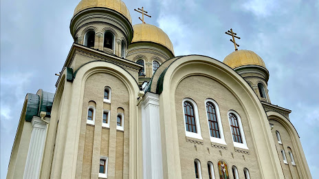
Photo
Where is located Svyato-Nikol'skiy Sobor
Svyato-Nikol'skiy Sobor — local attraction, which is located at Prospekt Mira, 19, Kislovodsk, Stavropol Krai, 357744 and belongs to the category — cathedral. Average visitor rating for this place — - (according to 110 ratings, information from open sources and relevant for 2022).
Exact location — Svyato-Nikol'skiy Sobor, marked on the map with a red marker.
You can get directions to Svyato-Nikol'skiy Sobor on the map from your location.
What else is interesting in Kislovodsk? You can see all the sights if you go to the city page.
Coordinates
Svyato-Nikol'skiy Sobor, Russian Federation coordinates in decimal format: latitude — 43.8935455215632, longitude — 42.71692649787204. When converted to degrees, minutes, seconds Svyato-Nikol'skiy Sobor has the following coordinates: 43°53′36.76 north latitude and 42°43′0.94 east longitude.
Nearby cities
The largest cities that are located nearby:
- Pyatigorsk — 30 km
- Cherkessk — 62 km
- Nalchik — 87 km
- Nevinnomyssk — 100 km
- Stavropol — 138 km
- Nazran — 182 km
- Kutaisi
 (Georgia) — 184 km
 - Vladikavkaz — 185 km
- Maykop — 221 km
- Sochi — 243 km
- Batumi (Georgia) — 267 km
- Elista — 291 km
- Tbilisi (Georgia) — 297 km
- Krasnodar — 318 km
- Khasavyurt — 320 km
- Gyumri
 (Armenia) — 358 km
 - Vanadzor (Armenia) — 375 km
- Volgodonsk — 399 km
- Novorossiysk — 400 km
Distance to the capital
Distance to the capital (Moscow) is about — 1368 km.