
 Mikhaylovka
Dyrestuy
Mikhaylovka
Mayskiy
Novobessergenevka
Tersky District
Lesnoy
Tertezh
Kuz'minskiye Otverzhki
Mikhaylovka
Dyrestuy
Mikhaylovka
Mayskiy
Novobessergenevka
Tersky District
Lesnoy
Tertezh
Kuz'minskiye Otverzhki
Museum of Minerals on the map, Angarsk, Russian Federation
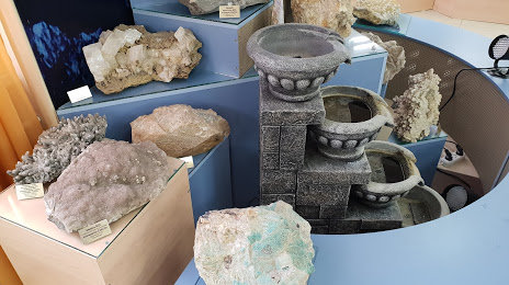
Photo
Where is located Museum of Minerals
Museum of Minerals — local attraction, which is located at 73th Quarter, 4, Angarsk, Irkutsk Oblast, 665830 and belongs to the category — museum. Average visitor rating for this place — 4.8 (according to 94 ratings, information from open sources and relevant for 2022).
Exact location — Museum of Minerals, marked on the map with a red marker.
You can get directions to Museum of Minerals on the map from your location.
What else is interesting in Angarsk? You can see all the sights if you go to the city page.
Coordinates
Museum of Minerals, Russian Federation coordinates in decimal format: latitude — 52.542189054669834, longitude — 103.88489259817479. When converted to degrees, minutes, seconds Museum of Minerals has the following coordinates: 52°32′31.88 north latitude and 103°53′5.61 east longitude.
Nearby cities
The largest cities that are located nearby:
- Ulan-Ude — 266 km
- Bratsk — 419 km
- Ulaanbaatar
 (Mongolia) — 559 km
 - Ust-Ilimsk — 607 km
- Kansk — 645 km
- Chita — 653 km
- Kyzyl — 654 km
- Krasnoyarsk — 781 km
- Abakan — 827 km
- Achinsk — 919 km
- Mezhdurechensk — 1045 km
- Novokuznetsk — 1105 km
- Prokopyevsk — 1130 km
- Leninsk-Kuznetskiy — 1158 km
- Tomsk — 1234 km
- Seversk — 1243 km
- Biysk — 1257 km
- Altay
 (China) — 1280 km
 - Barnaul — 1331 km
Distance to the capital
Distance to the capital (Moscow) is about — 4165 km.