
 Mikhaylovka
Dyrestuy
Mikhaylovka
Mayskiy
Novobessergenevka
Tersky District
Lesnoy
Tertezh
Kuz'minskiye Otverzhki
Mikhaylovka
Dyrestuy
Mikhaylovka
Mayskiy
Novobessergenevka
Tersky District
Lesnoy
Tertezh
Kuz'minskiye Otverzhki
Muzey Istorii Izucheniya I Osvoyeniya Yevropeyskogo Severa Rossii on the map, Apatity, Russian Federation
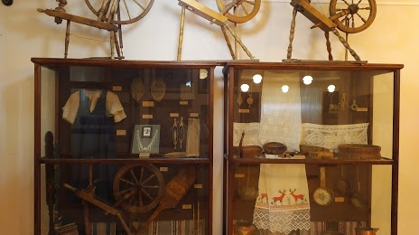
Photo
Where is located Muzey Istorii Izucheniya I Osvoyeniya Yevropeyskogo Severa Rossii
Muzey Istorii Izucheniya I Osvoyeniya Yevropeyskogo Severa Rossii — local attraction, which is located at Ulitsa Fersmana, 40а, Apatity, Murmansk Oblast, 184209 and belongs to the category — museum. Average visitor rating for this place — 4.8 (according to 25 ratings, information from open sources and relevant for 2022).
Exact location — Muzey Istorii Izucheniya I Osvoyeniya Yevropeyskogo Severa Rossii, marked on the map with a red marker.
You can get directions to Muzey Istorii Izucheniya I Osvoyeniya Yevropeyskogo Severa Rossii on the map from your location.
What else is interesting in Apatity? You can see all the sights if you go to the city page.
Coordinates
Muzey Istorii Izucheniya I Osvoyeniya Yevropeyskogo Severa Rossii, Russian Federation coordinates in decimal format: latitude — 67.57053671755656, longitude — 33.40385599878485. When converted to degrees, minutes, seconds Muzey Istorii Izucheniya I Osvoyeniya Yevropeyskogo Severa Rossii has the following coordinates: 67°34′13.93 north latitude and 33°24′13.88 east longitude.
Nearby cities
The largest cities that are located nearby:
- Severodvinsk — 452 km
- Oulu
 (Finland) — 466 km
 - Arkhangelsk — 477 km
- Petrozavodsk — 641 km
- Tampere (Finland) — 842 km
- Saint Petersburg — 861 km
- Kolpino — 880 km
- Vantaa (Finland) — 926 km
- Helsinki (Finland) — 941 km
- Espoo (Finland) — 945 km
- Cherepovets — 967 km
- Vologda — 994 km
- Turku (Finland) — 994 km
- Tallinn
 (Estonia) — 1022 km
 - Tartu (Estonia) — 1087 km
- Ukhta — 1093 km
- Rybinsk — 1099 km
- Pskov — 1118 km
- Syktyvkar — 1123 km
Distance to the capital
Distance to the capital (Moscow) is about — 1332 km.