
 Mikhaylovka
Dyrestuy
Mikhaylovka
Mayskiy
Novobessergenevka
Tersky District
Lesnoy
Tertezh
Kuz'minskiye Otverzhki
Mikhaylovka
Dyrestuy
Mikhaylovka
Mayskiy
Novobessergenevka
Tersky District
Lesnoy
Tertezh
Kuz'minskiye Otverzhki
Spaso-Preobrazhenskiy Sobor on the map, Arzamas, Russian Federation
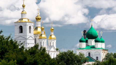
Photo
Where is located Spaso-Preobrazhenskiy Sobor
Spaso-Preobrazhenskiy Sobor — local attraction, which is located at Arzamas, Nizhny Novgorod Oblast, 607223 and belongs to the category — attraction. Average visitor rating for this place — 5.0 (according to 8 ratings, information from open sources and relevant for 2022).
Exact location — Spaso-Preobrazhenskiy Sobor, marked on the map with a red marker.
You can get directions to Spaso-Preobrazhenskiy Sobor on the map from your location.
What else is interesting in Arzamas? You can see all the sights if you go to the city page.
Coordinates
Spaso-Preobrazhenskiy Sobor, Russian Federation coordinates in decimal format: latitude — 55.384869507297, longitude — 43.81909999828284. When converted to degrees, minutes, seconds Spaso-Preobrazhenskiy Sobor has the following coordinates: 55°23′5.53 north latitude and 43°49′8.76 east longitude.
Nearby cities
The largest cities that are located nearby:
- Dzerzhinsk — 95 km
- Murom — 113 km
- Saransk — 161 km
- Kovrov — 186 km
- Vladimir — 225 km
- Cheboksary — 226 km
- Novocheboksarsk — 240 km
- Penza — 256 km
- Ryazan — 277 km
- Yoshkar-Ola — 282 km
- Zelenodolsk — 296 km
- Orekhovo-Zuyevo — 305 km
- Kostroma — 312 km
- Ulyanovsk — 317 km
- Kolomna — 321 km
- Kazan — 333 km
- Elektrostal — 335 km
- Noginsk — 336 km
- Tambov — 337 km
Distance to the capital
Distance to the capital (Moscow) is about — 392 km.