
 Mikhaylovka
Dyrestuy
Mikhaylovka
Mayskiy
Novobessergenevka
Tersky District
Lesnoy
Tertezh
Kuz'minskiye Otverzhki
Mikhaylovka
Dyrestuy
Mikhaylovka
Mayskiy
Novobessergenevka
Tersky District
Lesnoy
Tertezh
Kuz'minskiye Otverzhki
Mining Museum on the map, Arzamas, Russian Federation
Photo
Where is located Mining Museum
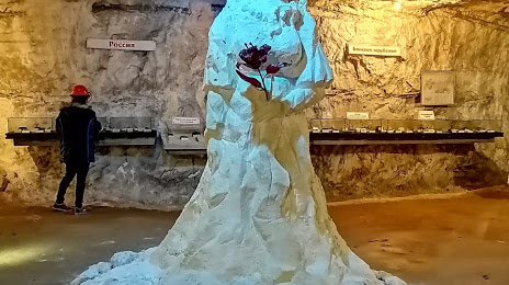
Mining Museum — local attraction, which is located at Nizhny Novgorod Oblast, 607264 and belongs to the category — museum. Average visitor rating for this place — 4.7 (according to 175 ratings, information from open sources and relevant for 2022).
Exact location — Mining Museum, marked on the map with a red marker.
You can get directions to Mining Museum on the map from your location.
What else is interesting in Arzamas? You can see all the sights if you go to the city page.
Coordinates
Mining Museum, Russian Federation coordinates in decimal format: latitude — 55.319236656727654, longitude — 43.94738219828031. When converted to degrees, minutes, seconds Mining Museum has the following coordinates: 55°19′9.25 north latitude and 43°56′50.58 east longitude.
Nearby cities
The largest cities that are located nearby:
- Dzerzhinsk — 95 km
- Murom — 113 km
- Saransk — 161 km
- Kovrov — 186 km
- Vladimir — 225 km
- Cheboksary — 226 km
- Novocheboksarsk — 240 km
- Penza — 256 km
- Ryazan — 277 km
- Yoshkar-Ola — 282 km
- Zelenodolsk — 296 km
- Orekhovo-Zuyevo — 305 km
- Kostroma — 312 km
- Ulyanovsk — 317 km
- Kolomna — 321 km
- Kazan — 333 km
- Elektrostal — 335 km
- Noginsk — 336 km
- Tambov — 337 km
Distance to the capital
Distance to the capital (Moscow) is about — 401 km.