
 Mikhaylovka
Dyrestuy
Mikhaylovka
Mayskiy
Novobessergenevka
Tersky District
Lesnoy
Tertezh
Kuz'minskiye Otverzhki
Mikhaylovka
Dyrestuy
Mikhaylovka
Mayskiy
Novobessergenevka
Tersky District
Lesnoy
Tertezh
Kuz'minskiye Otverzhki
Ozero Sestroretskiy Razliv on the map, Kronshtadt, Russian Federation
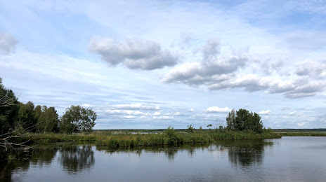
Photo
Where is located Ozero Sestroretskiy Razliv
Ozero Sestroretskiy Razliv — local attraction, which is located at 12.2 km² and belongs to the category — -. Average visitor rating for this place — 4.8 (according to 161 rating, information from open sources and relevant for 2022).
Exact location — Ozero Sestroretskiy Razliv, marked on the map with a red marker.
You can get directions to Ozero Sestroretskiy Razliv on the map from your location.
What else is interesting in Kronshtadt? You can see all the sights if you go to the city page.
Coordinates
Ozero Sestroretskiy Razliv, Russian Federation coordinates in decimal format: latitude — 60.084707672659825, longitude — 30.008820106254802. When converted to degrees, minutes, seconds Ozero Sestroretskiy Razliv has the following coordinates: 60°5′4.95 north latitude and 30°0′31.75 east longitude.
Nearby cities
The largest cities that are located nearby:
- Saint Petersburg — 32 km
- Kolpino — 55 km
- Tartu
 (Estonia) — 251 km
 - Pskov — 255 km
- Vantaa
 (Finland) — 261 km
 - Helsinki (Finland) — 266 km
- Espoo (Finland) — 282 km
- Tallinn (Estonia) — 288 km
- Petrozavodsk — 310 km
- Tampere (Finland) — 358 km
- Velikiye Luki — 407 km
- Turku (Finland) — 412 km
- Cherepovets — 472 km
- Rīga
 (Latvia) — 480 km
 - Daugavpils (Latvia) — 498 km
- Navapolatsk
 (Belarus) — 501 km
 - Tver — 509 km
- Rybinsk — 573 km
- Panevėžys
 (Lithuania) — 579 km
Distance to the capital
Distance to the capital (Moscow) is about — 658 km.