
 Mikhaylovka
Dyrestuy
Mikhaylovka
Mayskiy
Novobessergenevka
Tersky District
Lesnoy
Tertezh
Kuz'minskiye Otverzhki
Mikhaylovka
Dyrestuy
Mikhaylovka
Mayskiy
Novobessergenevka
Tersky District
Lesnoy
Tertezh
Kuz'minskiye Otverzhki
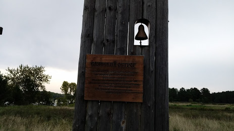
Sayanskiy Ostrog on the map, Sayanogorsk, Russian Federation
Photo
Where is located Sayanskiy Ostrog
Sayanskiy Ostrog — local attraction, which is located at Krasnoyarsk Krai, 662731 and belongs to the category — historical landmark. Average visitor rating for this place — 4.6 (according to 5 ratings, information from open sources and relevant for 2022).
Exact location — Sayanskiy Ostrog, marked on the map with a red marker.
You can get directions to Sayanskiy Ostrog on the map from your location.
What else is interesting in Sayanogorsk? You can see all the sights if you go to the city page.
Coordinates
Sayanskiy Ostrog, Russian Federation coordinates in decimal format: latitude — 53.14540030490141, longitude — 91.48672359819739. When converted to degrees, minutes, seconds Sayanskiy Ostrog has the following coordinates: 53°8′43.44 north latitude and 91°29′12.2 east longitude.
Nearby cities
The largest cities that are located nearby:
- Abakan — 69 km
- Mezhdurechensk — 230 km
- Kyzyl — 258 km
- Novokuznetsk — 290 km
- Prokopyevsk — 318 km
- Krasnoyarsk — 335 km
- Achinsk — 353 km
- Leninsk-Kuznetskiy — 378 km
- Biysk — 422 km
- Kansk — 433 km
- Barnaul — 505 km
- Tomsk — 543 km
- Seversk — 557 km
- Novosibirsk — 578 km
- Altay
 (China) — 629 km
 - Bratsk — 711 km
- Oskemen
 (Kazakhstan) — 716 km
 - Rubtsovsk — 724 km
- Semey (Kazakhstan) — 840 km
Distance to the capital
Distance to the capital (Moscow) is about — 3407 km.