
 Mikhaylovka
Dyrestuy
Mikhaylovka
Mayskiy
Novobessergenevka
Tersky District
Lesnoy
Tertezh
Kuz'minskiye Otverzhki
Mikhaylovka
Dyrestuy
Mikhaylovka
Mayskiy
Novobessergenevka
Tersky District
Lesnoy
Tertezh
Kuz'minskiye Otverzhki
Gora Zirgantau on the map, Salavat, Russian Federation
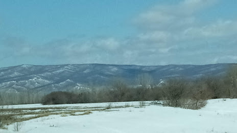
Photo
Where is located Gora Zirgantau
Gora Zirgantau — local attraction, which is located at 488 m and belongs to the category — -. Average visitor rating for this place — 5.0 (according to 4 ratings, information from open sources and relevant for 2022).
Exact location — Gora Zirgantau, marked on the map with a red marker.
You can get directions to Gora Zirgantau on the map from your location.
What else is interesting in Salavat? You can see all the sights if you go to the city page.
Coordinates
Gora Zirgantau, Russian Federation coordinates in decimal format: latitude — 53.22724130820898, longitude — 56.006666595670616. When converted to degrees, minutes, seconds Gora Zirgantau has the following coordinates: 53°13′38.07 north latitude and 56°0′24 east longitude.
Nearby cities
The largest cities that are located nearby:
- Sterlitamak — 29 km
- Ufa — 152 km
- Orenburg — 186 km
- Magnitogorsk — 202 km
- Almetyevsk — 285 km
- Novotroitsk — 290 km
- Orsk — 301 km
- Zlatoust — 309 km
- Neftekamsk — 319 km
- Miass — 320 km
- Nizhnekamsk — 359 km
- Sarapul — 367 km
- Samara — 384 km
- Novokuybyshevsk — 399 km
- Chelyabinsk — 400 km
- Izhevsk — 418 km
- Dimitrovgrad — 422 km
- Tolyatti — 429 km
- Pervouralsk — 461 km
Distance to the capital
Distance to the capital (Moscow) is about — 1217 km.