
 Mikhaylovka
Dyrestuy
Mikhaylovka
Mayskiy
Novobessergenevka
Tersky District
Lesnoy
Tertezh
Kuz'minskiye Otverzhki
Mikhaylovka
Dyrestuy
Mikhaylovka
Mayskiy
Novobessergenevka
Tersky District
Lesnoy
Tertezh
Kuz'minskiye Otverzhki
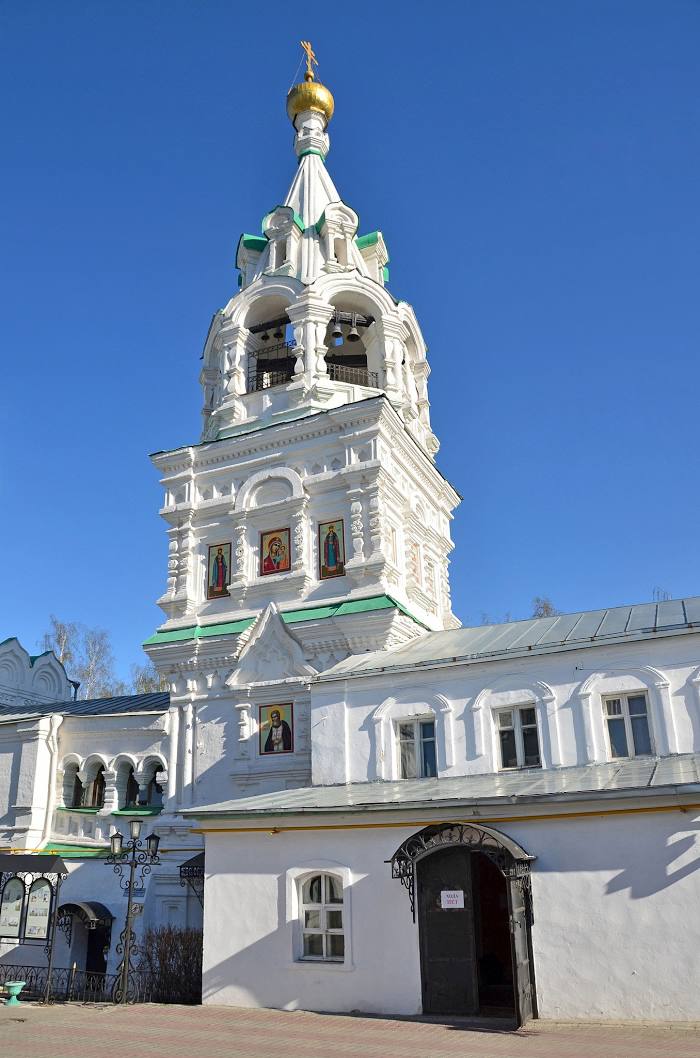
Svyato-Troitskiy Zhenskiy Monastyr' on the map, Murom, Russian Federation
Photo
Where is located Svyato-Troitskiy Zhenskiy Monastyr'
Svyato-Troitskiy Zhenskiy Monastyr' — local attraction, which is located at Peasant Square, 3а, Murom, Vladimir Oblast, 602267 and belongs to the category — convent. Average visitor rating for this place — 4.9 (according to 1557 ratings, information from open sources and relevant for 2022).
Exact location — Svyato-Troitskiy Zhenskiy Monastyr', marked on the map with a red marker.
You can get directions to Svyato-Troitskiy Zhenskiy Monastyr' on the map from your location.
What else is interesting in Murom? You can see all the sights if you go to the city page.
Coordinates
Svyato-Troitskiy Zhenskiy Monastyr', Russian Federation coordinates in decimal format: latitude — 55.58149325903305, longitude — 42.053063498290435. When converted to degrees, minutes, seconds Svyato-Troitskiy Zhenskiy Monastyr' has the following coordinates: 55°34′53.38 north latitude and 42°3′11.03 east longitude.
Nearby cities
The largest cities that are located nearby:
- Kovrov — 98 km
- Arzamas — 113 km
- Dzerzhinsk — 114 km
- Vladimir — 118 km
- Ryazan — 182 km
- Orekhovo-Zuyevo — 192 km
- Kolomna — 213 km
- Elektrostal — 223 km
- Noginsk — 224 km
- Kostroma — 252 km
- Balashikha — 254 km
- Saransk — 255 km
- Lyubertsy — 258 km
- Yaroslavl — 261 km
- Pushkino — 264 km
- Izmaylovo — 275 km
- Podolsk — 282 km
- Khimki — 287 km
- Odintsovo — 297 km
Distance to the capital
Distance to the capital (Moscow) is about — 279 km.