
 Mikhaylovka
Dyrestuy
Mikhaylovka
Mayskiy
Novobessergenevka
Tersky District
Lesnoy
Tertezh
Kuz'minskiye Otverzhki
Mikhaylovka
Dyrestuy
Mikhaylovka
Mayskiy
Novobessergenevka
Tersky District
Lesnoy
Tertezh
Kuz'minskiye Otverzhki
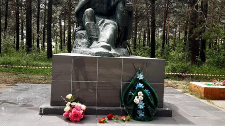
Memorial Zemlyanka on the map, Kansk, Russian Federation
Photo
Where is located Memorial Zemlyanka
Memorial Zemlyanka — local attraction, which is located at Kansk, Krasnoyarsk Krai, 663606 and belongs to the category — historical landmark. Average visitor rating for this place — 5.0 (according to 1 rating, information from open sources and relevant for 2022).
Exact location — Memorial Zemlyanka, marked on the map with a red marker.
You can get directions to Memorial Zemlyanka on the map from your location.
What else is interesting in Kansk? You can see all the sights if you go to the city page.
Coordinates
Memorial Zemlyanka, Russian Federation coordinates in decimal format: latitude — 56.24151517098436, longitude — 95.69152649831608. When converted to degrees, minutes, seconds Memorial Zemlyanka has the following coordinates: 56°14′29.45 north latitude and 95°41′29.5 east longitude.
Nearby cities
The largest cities that are located nearby:
- Krasnoyarsk — 176 km
- Achinsk — 321 km
- Bratsk — 363 km
- Abakan — 393 km
- Ust-Ilimsk — 453 km
- Kyzyl — 503 km
- Mezhdurechensk — 574 km
- Novokuznetsk — 623 km
- Leninsk-Kuznetskiy — 634 km
- Prokopyevsk — 640 km
- Tomsk — 655 km
- Seversk — 663 km
- Angarsk — 682 km
- Biysk — 814 km
- Novosibirsk — 821 km
- Barnaul — 849 km
- Ulan-Ude — 946 km
- Altay
 (China) — 1081 km
 - Rubtsovsk — 1125 km
Distance to the capital
Distance to the capital (Moscow) is about — 3504 km.