
 Mikhaylovka
Dyrestuy
Mikhaylovka
Mayskiy
Novobessergenevka
Tersky District
Lesnoy
Tertezh
Kuz'minskiye Otverzhki
Mikhaylovka
Dyrestuy
Mikhaylovka
Mayskiy
Novobessergenevka
Tersky District
Lesnoy
Tertezh
Kuz'minskiye Otverzhki
Paleta Beach on the map, Aksay, Russian Federation
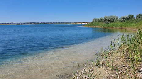
Photo
Where is located Paleta Beach
Paleta Beach — local attraction, which is located at no data and belongs to the category — -. Average visitor rating for this place — 4.4 (according to 159 ratings, information from open sources and relevant for 2022).
Exact location — Paleta Beach, marked on the map with a red marker.
You can get directions to Paleta Beach on the map from your location.
What else is interesting in Aksay? You can see all the sights if you go to the city page.
Coordinates
Paleta Beach, Russian Federation coordinates in decimal format: latitude — 47.194187900484145, longitude — 39.866215881662505. When converted to degrees, minutes, seconds Paleta Beach has the following coordinates: 47°11′39.08 north latitude and 39°51′58.38 east longitude.
Nearby cities
The largest cities that are located nearby:
- Bataysk — 17 km
- Novocherkassk — 23 km
- Shakhty — 56 km
- Taganrog — 72 km
- Luhansk
 — 151 km
 - Alchevs'k — 156 km
- Donetsk — 174 km
- Volgodonsk — 175 km
- Horlivka — 178 km
- Berdyans'k — 240 km
- Krasnodar — 256 km
- Maykop — 295 km
- Stavropol — 295 km
- Pavlohrad
 (Ukraine) — 324 km
 - Novorossiysk — 327 km
- Nevinnomyssk — 333 km
- Kerch — 338 km
- Melitopol' — 344 km
- Elista — 352 km
Distance to the capital
Distance to the capital (Moscow) is about — 965 km.