
 Mikhaylovka
Dyrestuy
Mikhaylovka
Mayskiy
Novobessergenevka
Tersky District
Lesnoy
Tertezh
Kuz'minskiye Otverzhki
Mikhaylovka
Dyrestuy
Mikhaylovka
Mayskiy
Novobessergenevka
Tersky District
Lesnoy
Tertezh
Kuz'minskiye Otverzhki
Neftekamskiy Istoriko-Krayevedcheskiy Muzey on the map, Neftekamsk, Russian Federation
Photo
Where is located Neftekamskiy Istoriko-Krayevedcheskiy Muzey
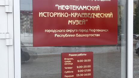
Neftekamskiy Istoriko-Krayevedcheskiy Muzey — local attraction, which is located at Prospekt Lenina, 17, Neftekamsk, Republic of Bashkortostan, 452680 and belongs to the category — history museum. Average visitor rating for this place — 4.5 (according to 34 ratings, information from open sources and relevant for 2022).
Exact location — Neftekamskiy Istoriko-Krayevedcheskiy Muzey, marked on the map with a red marker.
You can get directions to Neftekamskiy Istoriko-Krayevedcheskiy Muzey on the map from your location.
What else is interesting in Neftekamsk? You can see all the sights if you go to the city page.
Coordinates
Neftekamskiy Istoriko-Krayevedcheskiy Muzey, Russian Federation coordinates in decimal format: latitude — 56.08778914845669, longitude — 54.24644569846848. When converted to degrees, minutes, seconds Neftekamskiy Istoriko-Krayevedcheskiy Muzey has the following coordinates: 56°5′16.04 north latitude and 54°14′47.2 east longitude.
Nearby cities
The largest cities that are located nearby:
- Sarapul — 50 km
- Izhevsk — 105 km
- Nizhnekamsk — 163 km
- Almetyevsk — 183 km
- Ufa — 185 km
- Perm — 241 km
- Glazov — 244 km
- Sterlitamak — 294 km
- Salavat — 321 km
- Kazan — 322 km
- Pervouralsk — 353 km
- Zlatoust — 355 km
- Zelenodolsk — 359 km
- Dimitrovgrad — 369 km
- Kirov — 384 km
- Miass — 388 km
- Yekaterinburg — 391 km
- Berezniki — 392 km
- Yoshkar-Ola — 395 km
Distance to the capital
Distance to the capital (Moscow) is about — 1035 km.