
 Mikhaylovka
Dyrestuy
Mikhaylovka
Mayskiy
Novobessergenevka
Tersky District
Lesnoy
Tertezh
Kuz'minskiye Otverzhki
Mikhaylovka
Dyrestuy
Mikhaylovka
Mayskiy
Novobessergenevka
Tersky District
Lesnoy
Tertezh
Kuz'minskiye Otverzhki
Park "Gulliver" on the map, Neftekamsk, Russian Federation
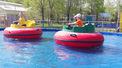
Photo
Where is located Park "Gulliver"
Park "Gulliver" — local attraction, which is located at пр-т. Комсомольский, 40, Neftekamsk, Republic of Bashkortostan, 452680 and belongs to the category — park. Average visitor rating for this place — 4.2 (according to 1636 ratings, information from open sources and relevant for 2022).
Exact location — Park "Gulliver", marked on the map with a red marker.
You can get directions to Park "Gulliver" on the map from your location.
What else is interesting in Neftekamsk? You can see all the sights if you go to the city page.
Coordinates
Park "Gulliver", Russian Federation coordinates in decimal format: latitude — 56.08882694466702, longitude — 54.24418819846851. When converted to degrees, minutes, seconds Park "Gulliver" has the following coordinates: 56°5′19.78 north latitude and 54°14′39.08 east longitude.
Nearby cities
The largest cities that are located nearby:
- Sarapul — 50 km
- Izhevsk — 105 km
- Nizhnekamsk — 163 km
- Almetyevsk — 183 km
- Ufa — 185 km
- Perm — 241 km
- Glazov — 244 km
- Sterlitamak — 294 km
- Salavat — 321 km
- Kazan — 322 km
- Pervouralsk — 353 km
- Zlatoust — 355 km
- Zelenodolsk — 359 km
- Dimitrovgrad — 369 km
- Kirov — 384 km
- Miass — 388 km
- Yekaterinburg — 391 km
- Berezniki — 392 km
- Yoshkar-Ola — 395 km
Distance to the capital
Distance to the capital (Moscow) is about — 1034 km.