
 Mikhaylovka
Dyrestuy
Mikhaylovka
Mayskiy
Novobessergenevka
Tersky District
Lesnoy
Tertezh
Kuz'minskiye Otverzhki
Mikhaylovka
Dyrestuy
Mikhaylovka
Mayskiy
Novobessergenevka
Tersky District
Lesnoy
Tertezh
Kuz'minskiye Otverzhki
Ozero Komsomol'skoye on the map, Nizhnevartovsk, Russian Federation
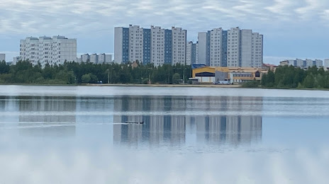
Photo
Where is located Ozero Komsomol'skoye
Ozero Komsomol'skoye — local attraction, which is located at no data and belongs to the category — -. Average visitor rating for this place — 4.4 (according to 46 ratings, information from open sources and relevant for 2022).
Exact location — Ozero Komsomol'skoye, marked on the map with a red marker.
You can get directions to Ozero Komsomol'skoye on the map from your location.
What else is interesting in Nizhnevartovsk? You can see all the sights if you go to the city page.
Coordinates
Ozero Komsomol'skoye, Russian Federation coordinates in decimal format: latitude — 60.95062386543262, longitude — 76.5772019790199. When converted to degrees, minutes, seconds Ozero Komsomol'skoye has the following coordinates: 60°57′2.25 north latitude and 76°34′37.93 east longitude.
Nearby cities
The largest cities that are located nearby:
- Surgut — 169 km
- Nefteyugansk — 212 km
- Omsk — 689 km
- Seversk — 697 km
- Tomsk — 712 km
- Novosibirsk — 771 km
- Tyumen — 782 km
- Kurgan — 927 km
- Leninsk-Kuznetskiy — 928 km
- Pavlodar
 (Kazakhstan) — 957 km
 - Barnaul — 965 km
- Kokshetau (Kazakhstan) — 968 km
- Achinsk — 1002 km
- Ekibastuz (Kazakhstan) — 1023 km
- Prokopyevsk — 1024 km
- Norilsk — 1033 km
- Novokuznetsk — 1053 km
- Yekaterinburg — 1065 km
- Rubtsovsk — 1090 km
Distance to the capital
Distance to the capital (Moscow) is about — 2308 km.