
 Mikhaylovka
Dyrestuy
Mikhaylovka
Mayskiy
Novobessergenevka
Tersky District
Lesnoy
Tertezh
Kuz'minskiye Otverzhki
Mikhaylovka
Dyrestuy
Mikhaylovka
Mayskiy
Novobessergenevka
Tersky District
Lesnoy
Tertezh
Kuz'minskiye Otverzhki
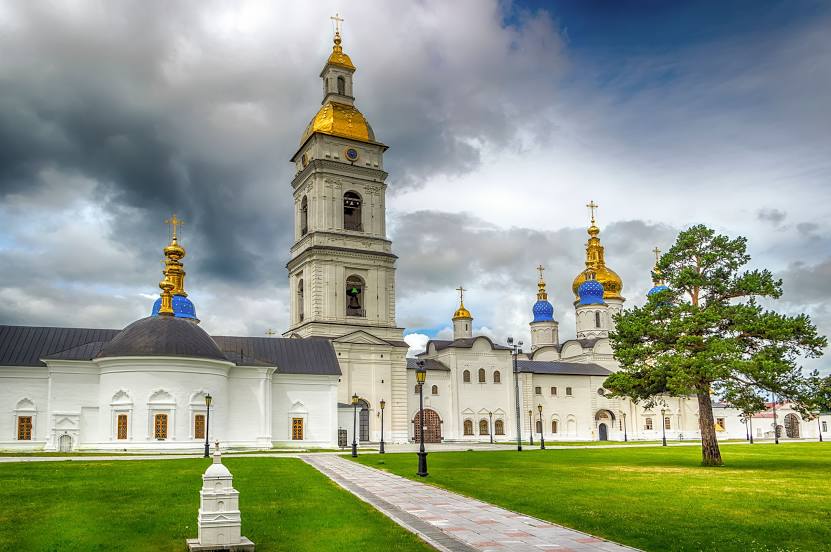
Tobol'skiy Kreml' on the map, Tobolsk, Russian Federation
Photo
Where is located Tobol'skiy Kreml'
Tobol'skiy Kreml' — local attraction, which is located at Ulitsa Krasnaya Ploshchad', 1с4, Tobolsk, Tyumen Oblast, 626156 and belongs to the category — historical place museum. Average visitor rating for this place — 4.8 (according to 5586 ratings, information from open sources and relevant for 2022).
Exact location — Tobol'skiy Kreml', marked on the map with a red marker.
You can get directions to Tobol'skiy Kreml' on the map from your location.
What else is interesting in Tobolsk? You can see all the sights if you go to the city page.
Coordinates
Tobol'skiy Kreml', Russian Federation coordinates in decimal format: latitude — 58.19897504548174, longitude — 68.25283979855186. When converted to degrees, minutes, seconds Tobol'skiy Kreml' has the following coordinates: 58°11′56.31 north latitude and 68°15′10.22 east longitude.
Nearby cities
The largest cities that are located nearby:
- Tyumen — 200 km
- Kurgan — 352 km
- Nefteyugansk — 395 km
- Surgut — 436 km
- Omsk — 481 km
- Yekaterinburg — 487 km
- Pervouralsk — 521 km
- Nizhnevartovsk — 539 km
- Chelyabinsk — 546 km
- Kokshetau
 (Kazakhstan) — 547 km
 - Miass — 626 km
- Kostanay (Kazakhstan) — 629 km
- Zlatoust — 638 km
- Berezniki — 660 km
- Solikamsk — 663 km
- Perm — 700 km
- Magnitogorsk — 807 km
- Ekibastuz (Kazakhstan) — 863 km
- Ufa — 872 km
Distance to the capital
Distance to the capital (Moscow) is about — 1860 km.