
 Mikhaylovka
Dyrestuy
Mikhaylovka
Mayskiy
Novobessergenevka
Tersky District
Lesnoy
Tertezh
Kuz'minskiye Otverzhki
Mikhaylovka
Dyrestuy
Mikhaylovka
Mayskiy
Novobessergenevka
Tersky District
Lesnoy
Tertezh
Kuz'minskiye Otverzhki
Volzhsky bridge on the map, Rybinsk, Russian Federation
Photo
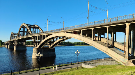
Where is located Volzhsky bridge
Volzhsky bridge — local attraction, which is located at R104, Rybinsk, Yaroslavl Oblast, 152906 and belongs to the category — bridge. Average visitor rating for this place — 4.6 (according to 181 rating, information from open sources and relevant for 2022).
Exact location — Volzhsky bridge, marked on the map with a red marker.
You can get directions to Volzhsky bridge on the map from your location.
What else is interesting in Rybinsk? You can see all the sights if you go to the city page.
Coordinates
Volzhsky bridge, Russian Federation coordinates in decimal format: latitude — 58.051044898231396, longitude — 38.86175879854589. When converted to degrees, minutes, seconds Volzhsky bridge has the following coordinates: 58°3′3.76 north latitude and 38°51′42.33 east longitude.
Nearby cities
The largest cities that are located nearby:
- Yaroslavl — 78 km
- Kostroma — 128 km
- Cherepovets — 131 km
- Vologda — 143 km
- Tver — 220 km
- Vladimir — 232 km
- Pushkino — 235 km
- Kovrov — 241 km
- Noginsk — 241 km
- Zelenograd — 249 km
- Orekhovo-Zuyevo — 249 km
- Elektrostal — 252 km
- Balashikha — 253 km
- Khimki — 253 km
- Lyubertsy — 268 km
- Odintsovo — 281 km
- Izmaylovo — 285 km
- Podolsk — 301 km
- Kolomna — 327 km
Distance to the capital
Distance to the capital (Moscow) is about — 266 km.