
 Mikhaylovka
Dyrestuy
Mikhaylovka
Mayskiy
Novobessergenevka
Tersky District
Lesnoy
Tertezh
Kuz'minskiye Otverzhki
Mikhaylovka
Dyrestuy
Mikhaylovka
Mayskiy
Novobessergenevka
Tersky District
Lesnoy
Tertezh
Kuz'minskiye Otverzhki
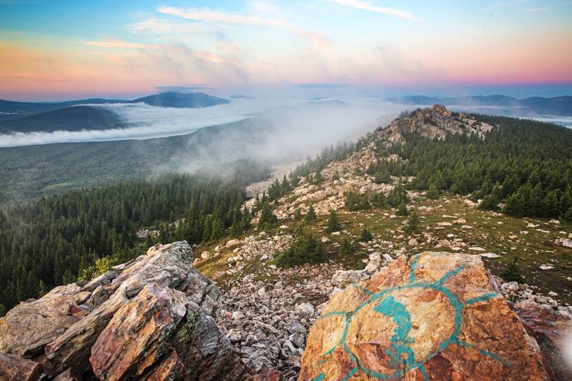
Parque nacional Zyuratkul on the map, Satka, Russian Federation
Photo
Where is located Parque nacional Zyuratkul
Parque nacional Zyuratkul — local attraction, which is located at ул. Комсомольская, 13, г. Сатка, Chelyabinsk Oblast, 456915 and belongs to the category — mountain range. Average visitor rating for this place — 4.7 (according to 1981 rating, information from open sources and relevant for 2022).
Exact location — Parque nacional Zyuratkul, marked on the map with a red marker.
You can get directions to Parque nacional Zyuratkul on the map from your location.
What else is interesting in Satka? You can see all the sights if you go to the city page.
Coordinates
Parque nacional Zyuratkul, Russian Federation coordinates in decimal format: latitude — 54.939202436423464, longitude — 58.99901555741273. When converted to degrees, minutes, seconds Parque nacional Zyuratkul has the following coordinates: 54°56′21.13 north latitude and 58°59′56.46 east longitude.
Nearby cities
The largest cities that are located nearby:
- Zlatoust — 42 km
- Miass — 68 km
- Chelyabinsk — 152 km
- Magnitogorsk — 181 km
- Ufa — 198 km
- Pervouralsk — 214 km
- Yekaterinburg — 219 km
- Sterlitamak — 256 km
- Salavat — 277 km
- Neftekamsk — 315 km
- Sarapul — 356 km
- Perm — 363 km
- Kostanay
 (Kazakhstan) — 366 km
 - Kurgan — 399 km
- Izhevsk — 405 km
- Orsk — 427 km
- Almetyevsk — 427 km
- Novotroitsk — 428 km
- Orenburg — 452 km
Distance to the capital
Distance to the capital (Moscow) is about — 1350 km.