
 Mikhaylovka
Dyrestuy
Mikhaylovka
Mayskiy
Novobessergenevka
Tersky District
Lesnoy
Tertezh
Kuz'minskiye Otverzhki
Mikhaylovka
Dyrestuy
Mikhaylovka
Mayskiy
Novobessergenevka
Tersky District
Lesnoy
Tertezh
Kuz'minskiye Otverzhki
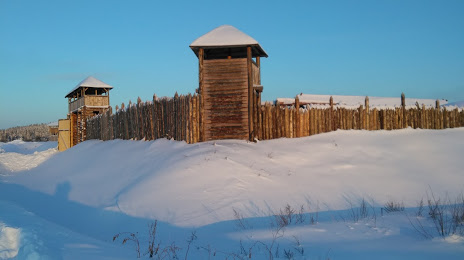
Istoricheskiy Park Bastion on the map, Sortavala, Russian Federation
Photo
Where is located Istoricheskiy Park Bastion
Istoricheskiy Park Bastion — local attraction, which is located at Ulitsa Priozernaya, Sortavala, Republic of Karelia, 186790 and belongs to the category — museum. Average visitor rating for this place — 4.7 (according to 537 ratings, information from open sources and relevant for 2022).
Exact location — Istoricheskiy Park Bastion, marked on the map with a red marker.
You can get directions to Istoricheskiy Park Bastion on the map from your location.
What else is interesting in Sortavala? You can see all the sights if you go to the city page.
Coordinates
Istoricheskiy Park Bastion, Russian Federation coordinates in decimal format: latitude — 61.711305269724065, longitude — 30.725135198694623. When converted to degrees, minutes, seconds Istoricheskiy Park Bastion has the following coordinates: 61°42′40.7 north latitude and 30°43′30.49 east longitude.
Nearby cities
The largest cities that are located nearby:
- Petrozavodsk — 192 km
- Saint Petersburg — 196 km
- Kolpino — 217 km
- Vantaa
 (Finland) — 345 km
 - Helsinki (Finland) — 357 km
- Tampere (Finland) — 365 km
- Espoo (Finland) — 369 km
- Tallinn
 (Estonia) — 416 km
 - Tartu (Estonia) — 432 km
- Oulu (Finland) — 439 km
- Pskov — 451 km
- Turku (Finland) — 478 km
- Cherepovets — 499 km
- Severodvinsk — 540 km
- Arkhangelsk — 566 km
- Vologda — 590 km
- Velikiye Luki — 593 km
- Tver — 622 km
- Rybinsk — 625 km
Distance to the capital
Distance to the capital (Moscow) is about — 772 km.