
 Mikhaylovka
Dyrestuy
Mikhaylovka
Mayskiy
Novobessergenevka
Tersky District
Lesnoy
Tertezh
Kuz'minskiye Otverzhki
Mikhaylovka
Dyrestuy
Mikhaylovka
Mayskiy
Novobessergenevka
Tersky District
Lesnoy
Tertezh
Kuz'minskiye Otverzhki
Voyenno-Istoricheskiy Muzey Fortifikatsionnykh Sooruzheniy on the map, Sevastopol, Sevastopol' city
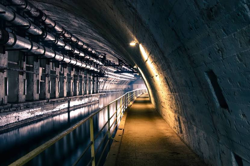
Photo
Where is located Voyenno-Istoricheskiy Muzey Fortifikatsionnykh Sooruzheniy
Voyenno-Istoricheskiy Muzey Fortifikatsionnykh Sooruzheniy — local attraction, which is located at 1 99000, Marmurova St, Sevastopol and belongs to the category — museum. Average visitor rating for this place — 4.6 (according to 4340 ratings, information from open sources and relevant for 2022).
Exact location — Voyenno-Istoricheskiy Muzey Fortifikatsionnykh Sooruzheniy, marked on the map with a red marker.
You can get directions to Voyenno-Istoricheskiy Muzey Fortifikatsionnykh Sooruzheniy on the map from your location.
What else is interesting in Sevastopol? You can see all the sights if you go to the city page.
Coordinates
Voyenno-Istoricheskiy Muzey Fortifikatsionnykh Sooruzheniy coordinates in decimal format: latitude — 44.50110860611366, longitude — 33.596536098050485. When converted to degrees, minutes, seconds Voyenno-Istoricheskiy Muzey Fortifikatsionnykh Sooruzheniy has the following coordinates: 44°30′3.99 north latitude and 33°35′47.53 east longitude.
Nearby cities
The largest cities that are located nearby:
- Simferopol — 58 km
- Yevpatoriya — 65 km
- Kherson
 — 234 km
 - Kerch — 243 km
- Melitopol' — 282 km
- Odessa
 (Ukraine) — 297 km
 - Novorossiysk — 332 km
- Nikopol' (Ukraine) — 333 km
- Berdyans'k — 342 km
- Kryvyi Rih (Ukraine) — 364 km
- Zonguldak
 (Turkey) — 378 km
 - Constanța
 (Romania) — 391 km
 - Bender
 (Moldova) — 392 km
 - Krasnodar — 428 km
- Galați (Romania) — 435 km
- Samsun (Turkey) — 435 km
- Chisinau (Moldova) — 436 km
- Dniprodzerzhyns'k (Ukraine) — 439 km
- Brăila (Romania) — 439 km
Distance to the capital
Distance to the capital (Moscow) is about — 1284 km.