
 Mikhaylovka
Dyrestuy
Mikhaylovka
Mayskiy
Novobessergenevka
Tersky District
Lesnoy
Tertezh
Kuz'minskiye Otverzhki
Mikhaylovka
Dyrestuy
Mikhaylovka
Mayskiy
Novobessergenevka
Tersky District
Lesnoy
Tertezh
Kuz'minskiye Otverzhki
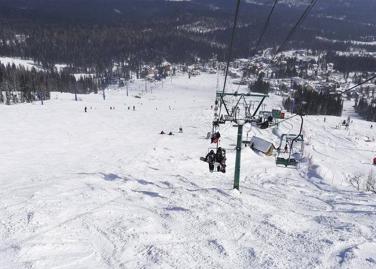
Sheregesh on the map, Sheregesh, Russian Federation
Photo
Where is located Sheregesh
Sheregesh — local attraction, which is located at Kemerovo Oblast, 652971 and belongs to the category — ski resort. Average visitor rating for this place — 4.8 (according to 1202 ratings, information from open sources and relevant for 2022).
Exact location — Sheregesh, marked on the map with a red marker.
You can get directions to Sheregesh on the map from your location.
What else is interesting in Sheregesh? You can see all the sights if you go to the city page.
Coordinates
Sheregesh, Russian Federation coordinates in decimal format: latitude — 52.922333032728524, longitude — 87.99237413626565. When converted to degrees, minutes, seconds Sheregesh has the following coordinates: 52°55′20.4 north latitude and 87°59′32.55 east longitude.
Nearby cities
The largest cities that are located nearby:
- Mezhdurechensk — 84 km
- Novokuznetsk — 108 km
- Prokopyevsk — 135 km
- Biysk — 192 km
- Leninsk-Kuznetskiy — 224 km
- Abakan — 240 km
- Barnaul — 283 km
- Novosibirsk — 395 km
- Achinsk — 398 km
- Tomsk — 436 km
- Seversk — 449 km
- Krasnoyarsk — 456 km
- Kyzyl — 462 km
- Rubtsovsk — 493 km
- Oskemen
 (Kazakhstan) — 503 km
 - Altay
 (China) — 562 km
 - Kansk — 597 km
- Semey (Kazakhstan) — 612 km
- Pavlodar (Kazakhstan) — 749 km
Distance to the capital
Distance to the capital (Moscow) is about — 3209 km.