
 Mikhaylovka
Dyrestuy
Mikhaylovka
Mayskiy
Novobessergenevka
Tersky District
Lesnoy
Tertezh
Kuz'minskiye Otverzhki
Mikhaylovka
Dyrestuy
Mikhaylovka
Mayskiy
Novobessergenevka
Tersky District
Lesnoy
Tertezh
Kuz'minskiye Otverzhki
Maloyaroslavetskiy Voyenno-Istoricheskiy Muzey 1812 Goda on the map, Maloyaroslavets, Russian Federation
Photo
Where is located Maloyaroslavetskiy Voyenno-Istoricheskiy Muzey 1812 Goda
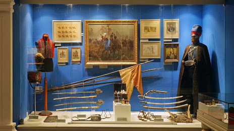
Maloyaroslavetskiy Voyenno-Istoricheskiy Muzey 1812 Goda — local attraction, which is located at Moskovskaya Ulitsa, 27, Maloyaroslavets, Kaluga Oblast, 249096 and belongs to the category — history museum. Average visitor rating for this place — 4.7 (according to 139 ratings, information from open sources and relevant for 2022).
Exact location — Maloyaroslavetskiy Voyenno-Istoricheskiy Muzey 1812 Goda, marked on the map with a red marker.
You can get directions to Maloyaroslavetskiy Voyenno-Istoricheskiy Muzey 1812 Goda on the map from your location.
What else is interesting in Maloyaroslavets? You can see all the sights if you go to the city page.
Coordinates
Maloyaroslavetskiy Voyenno-Istoricheskiy Muzey 1812 Goda, Russian Federation coordinates in decimal format: latitude — 55.01246195017279, longitude — 36.47434519842684. When converted to degrees, minutes, seconds Maloyaroslavetskiy Voyenno-Istoricheskiy Muzey 1812 Goda has the following coordinates: 55°0′44.86 north latitude and 36°28′27.64 east longitude.
Nearby cities
The largest cities that are located nearby:
- Obninsk — 14 km
- Kaluga — 53 km
- Serpukhov — 62 km
- Podolsk — 82 km
- Odintsovo — 87 km
- Izmaylovo — 95 km
- Khimki — 114 km
- Lyubertsy — 116 km
- Tula — 117 km
- Zelenograd — 117 km
- Balashikha — 128 km
- Pushkino — 138 km
- Kolomna — 146 km
- Elektrostal — 150 km
- Noginsk — 156 km
- Novomoskovsk — 163 km
- Orekhovo-Zuyevo — 178 km
- Tver — 206 km
- Ryazan — 213 km
Distance to the capital
Distance to the capital (Moscow) is about — 110 km.