
 Mikhaylovka
Dyrestuy
Mikhaylovka
Mayskiy
Novobessergenevka
Tersky District
Lesnoy
Tertezh
Kuz'minskiye Otverzhki
Mikhaylovka
Dyrestuy
Mikhaylovka
Mayskiy
Novobessergenevka
Tersky District
Lesnoy
Tertezh
Kuz'minskiye Otverzhki
Valdaysky National Park on the map, Valday, Russian Federation
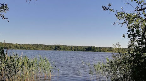
Photo
Where is located Valdaysky National Park
Valdaysky National Park — local attraction, which is located at Novgorod Oblast, 175423 and belongs to the category — national park. Average visitor rating for this place — 4.7 (according to 4316 ratings, information from open sources and relevant for 2022).
Exact location — Valdaysky National Park, marked on the map with a red marker.
You can get directions to Valdaysky National Park on the map from your location.
What else is interesting in Valday? You can see all the sights if you go to the city page.
Coordinates
Valdaysky National Park, Russian Federation coordinates in decimal format: latitude — 57.96613038222374, longitude — 33.22818445783189. When converted to degrees, minutes, seconds Valdaysky National Park has the following coordinates: 57°57′58.07 north latitude and 33°13′41.46 east longitude.
Nearby cities
The largest cities that are located nearby:
- Tver — 203 km
- Kolpino — 245 km
- Velikiye Luki — 245 km
- Saint Petersburg — 271 km
- Pskov — 290 km
- Cherepovets — 294 km
- Zelenograd — 327 km
- Rybinsk — 327 km
- Khimki — 347 km
- Odintsovo — 357 km
- Pushkino — 357 km
- Smolensk — 359 km
- Balashikha — 377 km
- Obninsk — 380 km
- Tartu
 (Estonia) — 381 km
 - Izmaylovo — 382 km
- Lyubertsy — 384 km
- Podolsk — 389 km
- Yaroslavl — 395 km
Distance to the capital
Distance to the capital (Moscow) is about — 363 km.