
 Mikhaylovka
Dyrestuy
Mikhaylovka
Mayskiy
Novobessergenevka
Tersky District
Lesnoy
Tertezh
Kuz'minskiye Otverzhki
Mikhaylovka
Dyrestuy
Mikhaylovka
Mayskiy
Novobessergenevka
Tersky District
Lesnoy
Tertezh
Kuz'minskiye Otverzhki
Permusozero on the map, Olenegorsk, Russian Federation
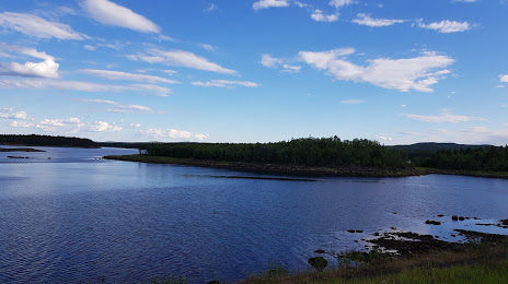
Photo
Where is located Permusozero
Permusozero — local attraction, which is located at 142 m and belongs to the category — -. Average visitor rating for this place — 4.7 (according to 116 ratings, information from open sources and relevant for 2022).
Exact location — Permusozero, marked on the map with a red marker.
You can get directions to Permusozero on the map from your location.
What else is interesting in Olenegorsk? You can see all the sights if you go to the city page.
Coordinates
Permusozero, Russian Federation coordinates in decimal format: latitude — 68.1373998101756, longitude — 33.27508005070269. When converted to degrees, minutes, seconds Permusozero has the following coordinates: 68°8′14.64 north latitude and 33°16′30.29 east longitude.
Nearby cities
The largest cities that are located nearby:
- Oulu
 (Finland) — 502 km
 - Severodvinsk — 505 km
- Arkhangelsk — 528 km
- Petrozavodsk — 705 km
- Tampere (Finland) — 889 km
- Saint Petersburg — 922 km
- Kolpino — 941 km
- Vantaa (Finland) — 978 km
- Helsinki (Finland) — 993 km
- Espoo (Finland) — 997 km
- Cherepovets — 1031 km
- Turku (Finland) — 1040 km
- Vologda — 1056 km
- Tallinn
 (Estonia) — 1075 km
 - Ukhta — 1126 km
- Tartu (Estonia) — 1144 km
- Rybinsk — 1163 km
- Syktyvkar — 1167 km
- Pskov — 1178 km
Distance to the capital
Distance to the capital (Moscow) is about — 1395 km.