
 Mikhaylovka
Dyrestuy
Mikhaylovka
Mayskiy
Novobessergenevka
Tersky District
Lesnoy
Tertezh
Kuz'minskiye Otverzhki
Mikhaylovka
Dyrestuy
Mikhaylovka
Mayskiy
Novobessergenevka
Tersky District
Lesnoy
Tertezh
Kuz'minskiye Otverzhki
Park Aleksandriya on the map, Krasnoye Selo, Russian Federation
Photo
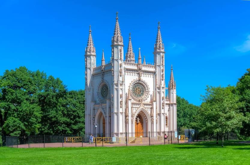
Where is located Park Aleksandriya
Park Aleksandriya — local attraction, which is located at новый Петергоф вокзал, ул. Демьяна Бедного, St Petersburg, 198510 and belongs to the category — park. Average visitor rating for this place — 4.8 (according to 4866 ratings, information from open sources and relevant for 2022).
Exact location — Park Aleksandriya, marked on the map with a red marker.
You can get directions to Park Aleksandriya on the map from your location.
What else is interesting in Krasnoye Selo? You can see all the sights if you go to the city page.
Coordinates
Park Aleksandriya, Russian Federation coordinates in decimal format: latitude — 59.88261139301006, longitude — 29.941316998619655. When converted to degrees, minutes, seconds Park Aleksandriya has the following coordinates: 59°52′57.4 north latitude and 29°56′28.74 east longitude.
Nearby cities
The largest cities that are located nearby:
- Saint Petersburg — 26 km
- Kolpino — 29 km
- Pskov — 236 km
- Tartu
 (Estonia) — 246 km
 - Vantaa
 (Finland) — 283 km
 - Helsinki (Finland) — 287 km
- Tallinn (Estonia) — 301 km
- Espoo (Finland) — 303 km
- Petrozavodsk — 317 km
- Velikiye Luki — 376 km
- Tampere (Finland) — 386 km
- Turku (Finland) — 434 km
- Cherepovets — 449 km
- Rīga
 (Latvia) — 474 km
 - Tver — 475 km
- Navapolatsk
 (Belarus) — 476 km
 - Daugavpils (Latvia) — 480 km
- Rybinsk — 545 km
- Vologda — 558 km
Distance to the capital
Distance to the capital (Moscow) is about — 645 km.