
 Mikhaylovka
Dyrestuy
Mikhaylovka
Mayskiy
Novobessergenevka
Tersky District
Lesnoy
Tertezh
Kuz'minskiye Otverzhki
Mikhaylovka
Dyrestuy
Mikhaylovka
Mayskiy
Novobessergenevka
Tersky District
Lesnoy
Tertezh
Kuz'minskiye Otverzhki
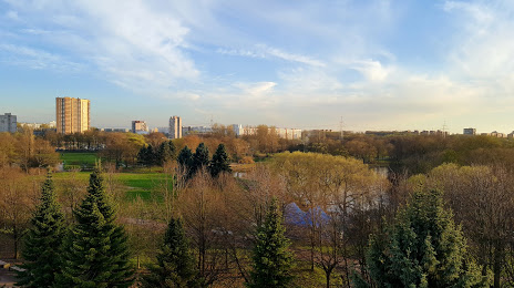
Yuzhno-Primorskiy Park on the map, Krasnoye Selo, Russian Federation
Photo
Where is located Yuzhno-Primorskiy Park
Yuzhno-Primorskiy Park — local attraction, which is located at Petergofskoye Shosse, 27, St Petersburg, 198328 and belongs to the category — park. Average visitor rating for this place — 4.5 (according to 11007 ratings, information from open sources and relevant for 2022).
Exact location — Yuzhno-Primorskiy Park, marked on the map with a red marker.
You can get directions to Yuzhno-Primorskiy Park on the map from your location.
What else is interesting in Krasnoye Selo? You can see all the sights if you go to the city page.
Coordinates
Yuzhno-Primorskiy Park, Russian Federation coordinates in decimal format: latitude — 59.8530885053584, longitude — 30.170358998618457. When converted to degrees, minutes, seconds Yuzhno-Primorskiy Park has the following coordinates: 59°51′11.12 north latitude and 30°10′13.29 east longitude.
Nearby cities
The largest cities that are located nearby:
- Saint Petersburg — 26 km
- Kolpino — 29 km
- Pskov — 236 km
- Tartu
 (Estonia) — 246 km
 - Vantaa
 (Finland) — 283 km
 - Helsinki (Finland) — 287 km
- Tallinn (Estonia) — 301 km
- Espoo (Finland) — 303 km
- Petrozavodsk — 317 km
- Velikiye Luki — 376 km
- Tampere (Finland) — 386 km
- Turku (Finland) — 434 km
- Cherepovets — 449 km
- Rīga
 (Latvia) — 474 km
 - Tver — 475 km
- Navapolatsk
 (Belarus) — 476 km
 - Daugavpils (Latvia) — 480 km
- Rybinsk — 545 km
- Vologda — 558 km
Distance to the capital
Distance to the capital (Moscow) is about — 634 km.