
 Mikhaylovka
Dyrestuy
Mikhaylovka
Mayskiy
Novobessergenevka
Tersky District
Lesnoy
Tertezh
Kuz'minskiye Otverzhki
Mikhaylovka
Dyrestuy
Mikhaylovka
Mayskiy
Novobessergenevka
Tersky District
Lesnoy
Tertezh
Kuz'minskiye Otverzhki
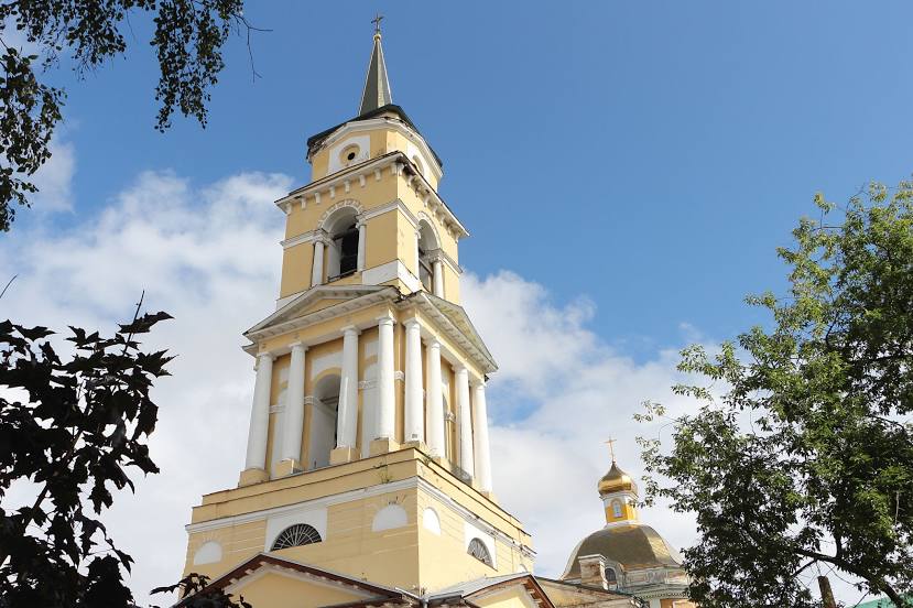
Spaso-Preobrazhenskiy Sobor on the map, Shadrinsk, Russian Federation
Photo
Where is located Spaso-Preobrazhenskiy Sobor
Spaso-Preobrazhenskiy Sobor — local attraction, which is located at Shadrinsk, Kurgan Oblast, 641870 and belongs to the category — orthodox church. Average visitor rating for this place — 4.6 (according to 123 ratings, information from open sources and relevant for 2022).
Exact location — Spaso-Preobrazhenskiy Sobor, marked on the map with a red marker.
You can get directions to Spaso-Preobrazhenskiy Sobor on the map from your location.
What else is interesting in Shadrinsk? You can see all the sights if you go to the city page.
Coordinates
Spaso-Preobrazhenskiy Sobor, Russian Federation coordinates in decimal format: latitude — 56.07719398714394, longitude — 63.6335205984681. When converted to degrees, minutes, seconds Spaso-Preobrazhenskiy Sobor has the following coordinates: 56°4′37.9 north latitude and 63°38′0.67 east longitude.
Nearby cities
The largest cities that are located nearby:
- Kurgan — 128 km
- Tyumen — 164 km
- Chelyabinsk — 172 km
- Yekaterinburg — 201 km
- Pervouralsk — 240 km
- Miass — 254 km
- Zlatoust — 271 km
- Kostanay
 (Kazakhstan) — 317 km
 - Magnitogorsk — 425 km
- Perm — 478 km
- Kokshetau (Kazakhstan) — 491 km
- Ufa — 511 km
- Berezniki — 533 km
- Solikamsk — 550 km
- Sterlitamak — 572 km
- Neftekamsk — 576 km
- Salavat — 590 km
- Sarapul — 602 km
- Omsk — 629 km
Distance to the capital
Distance to the capital (Moscow) is about — 1612 km.