
 Mikhaylovka
Dyrestuy
Mikhaylovka
Mayskiy
Novobessergenevka
Tersky District
Lesnoy
Tertezh
Kuz'minskiye Otverzhki
Mikhaylovka
Dyrestuy
Mikhaylovka
Mayskiy
Novobessergenevka
Tersky District
Lesnoy
Tertezh
Kuz'minskiye Otverzhki
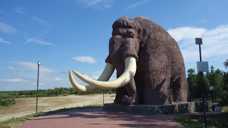
Pamyatnik Mamontu on the map, Labytnangi, Russian Federation
Photo
Where is located Pamyatnik Mamontu
Pamyatnik Mamontu — local attraction, which is located at Yamalo-Nenets Autonomous Okrug, 629004 and belongs to the category — monument. Average visitor rating for this place — 4.6 (according to 363 ratings, information from open sources and relevant for 2022).
Exact location — Pamyatnik Mamontu, marked on the map with a red marker.
You can get directions to Pamyatnik Mamontu on the map from your location.
What else is interesting in Labytnangi? You can see all the sights if you go to the city page.
Coordinates
Pamyatnik Mamontu, Russian Federation coordinates in decimal format: latitude — 66.6233576225993, longitude — 66.56022739890227. When converted to degrees, minutes, seconds Pamyatnik Mamontu has the following coordinates: 66°37′24.09 north latitude and 66°33′36.82 east longitude.
Nearby cities
The largest cities that are located nearby:
- Nefteyugansk — 697 km
- Surgut — 705 km
- Ukhta — 713 km
- Nizhnevartovsk — 834 km
- Norilsk — 901 km
- Solikamsk — 945 km
- Berezniki — 967 km
- Syktyvkar — 987 km
- Tyumen — 1051 km
- Perm — 1125 km
- Yekaterinburg — 1141 km
- Pervouralsk — 1145 km
- Glazov — 1238 km
- Kurgan — 1239 km
- Arkhangelsk — 1251 km
- Severodvinsk — 1282 km
- Chelyabinsk — 1309 km
- Kirov — 1313 km
- Zlatoust — 1340 km
Distance to the capital
Distance to the capital (Moscow) is about — 1937 km.