
 Mikhaylovka
Dyrestuy
Mikhaylovka
Mayskiy
Novobessergenevka
Tersky District
Lesnoy
Tertezh
Kuz'minskiye Otverzhki
Mikhaylovka
Dyrestuy
Mikhaylovka
Mayskiy
Novobessergenevka
Tersky District
Lesnoy
Tertezh
Kuz'minskiye Otverzhki
Mineralogicheskij muzej «SHtufnoj kabinet» on the map, Severouralsk, Russian Federation
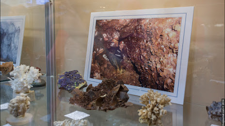
Photo
Where is located Mineralogicheskij muzej «SHtufnoj kabinet»
Mineralogicheskij muzej «SHtufnoj kabinet» — local attraction, which is located at Ulitsa Vatutina, 17а, Severouralsk, Sverdlovsk Oblast, 624480 and belongs to the category — museum. Average visitor rating for this place — 4.9 (according to 14 ratings, information from open sources and relevant for 2022).
Exact location — Mineralogicheskij muzej «SHtufnoj kabinet», marked on the map with a red marker.
You can get directions to Mineralogicheskij muzej «SHtufnoj kabinet» on the map from your location.
What else is interesting in Severouralsk? You can see all the sights if you go to the city page.
Coordinates
Mineralogicheskij muzej «SHtufnoj kabinet», Russian Federation coordinates in decimal format: latitude — 60.15723634632962, longitude — 59.97000949863079. When converted to degrees, minutes, seconds Mineralogicheskij muzej «SHtufnoj kabinet» has the following coordinates: 60°9′26.05 north latitude and 59°58′12.03 east longitude.
Nearby cities
The largest cities that are located nearby:
- Solikamsk — 188 km
- Berezniki — 196 km
- Perm — 320 km
- Pervouralsk — 358 km
- Yekaterinburg — 369 km
- Tyumen — 470 km
- Glazov — 481 km
- Ukhta — 487 km
- Syktyvkar — 508 km
- Izhevsk — 550 km
- Zlatoust — 552 km
- Sarapul — 555 km
- Chelyabinsk — 560 km
- Neftekamsk — 568 km
- Miass — 570 km
- Kirov — 617 km
- Kurgan — 619 km
- Ufa — 651 km
- Nefteyugansk — 683 km
Distance to the capital
Distance to the capital (Moscow) is about — 1399 km.