
 Mikhaylovka
Dyrestuy
Mikhaylovka
Mayskiy
Novobessergenevka
Tersky District
Lesnoy
Tertezh
Kuz'minskiye Otverzhki
Mikhaylovka
Dyrestuy
Mikhaylovka
Mayskiy
Novobessergenevka
Tersky District
Lesnoy
Tertezh
Kuz'minskiye Otverzhki
Borovsky Museum of Local History on the map, Borovsk, Russian Federation
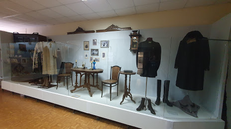
Photo
Where is located Borovsky Museum of Local History
Borovsky Museum of Local History — local attraction, which is located at Lenina Ploshchad', 6, Borovsk, Kaluga Oblast, 249010 and belongs to the category — museum. Average visitor rating for this place — 4.5 (according to 28 ratings, information from open sources and relevant for 2022).
Exact location — Borovsky Museum of Local History, marked on the map with a red marker.
You can get directions to Borovsky Museum of Local History on the map from your location.
What else is interesting in Borovsk? You can see all the sights if you go to the city page.
Coordinates
Borovsky Museum of Local History, Russian Federation coordinates in decimal format: latitude — 55.20823874356588, longitude — 36.482741298434455. When converted to degrees, minutes, seconds Borovsky Museum of Local History has the following coordinates: 55°12′29.66 north latitude and 36°28′57.87 east longitude.
Nearby cities
The largest cities that are located nearby:
- Obninsk — 11 km
- Serpukhov — 66 km
- Odintsovo — 70 km
- Podolsk — 70 km
- Kaluga — 73 km
- Izmaylovo — 82 km
- Khimki — 97 km
- Zelenograd — 98 km
- Lyubertsy — 102 km
- Balashikha — 114 km
- Pushkino — 121 km
- Tula — 132 km
- Elektrostal — 138 km
- Noginsk — 143 km
- Kolomna — 144 km
- Orekhovo-Zuyevo — 167 km
- Novomoskovsk — 176 km
- Tver — 187 km
- Ryazan — 216 km
Distance to the capital
Distance to the capital (Moscow) is about — 94 km.