
 Mikhaylovka
Dyrestuy
Mikhaylovka
Mayskiy
Novobessergenevka
Tersky District
Lesnoy
Tertezh
Kuz'minskiye Otverzhki
Mikhaylovka
Dyrestuy
Mikhaylovka
Mayskiy
Novobessergenevka
Tersky District
Lesnoy
Tertezh
Kuz'minskiye Otverzhki
«Irbit-EKSPO». on the map, Irbit, Russian Federation
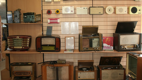
Photo
Where is located «Irbit-EKSPO».
«Irbit-EKSPO». — local attraction, which is located at Ulitsa Sovetskaya, 100, Irbit, Sverdlovsk Oblast, 623850 and belongs to the category — museum. Average visitor rating for this place — 4.9 (according to 7 ratings, information from open sources and relevant for 2022).
Exact location — «Irbit-EKSPO»., marked on the map with a red marker.
You can get directions to «Irbit-EKSPO». on the map from your location.
What else is interesting in Irbit? You can see all the sights if you go to the city page.
Coordinates
«Irbit-EKSPO»., Russian Federation coordinates in decimal format: latitude — 57.664206739464426, longitude — 63.087914998530486. When converted to degrees, minutes, seconds «Irbit-EKSPO». has the following coordinates: 57°39′51.14 north latitude and 63°5′16.49 east longitude.
Nearby cities
The largest cities that are located nearby:
- Tyumen — 158 km
- Yekaterinburg — 175 km
- Pervouralsk — 206 km
- Kurgan — 282 km
- Chelyabinsk — 295 km
- Miass — 350 km
- Zlatoust — 350 km
- Perm — 397 km
- Berezniki — 403 km
- Solikamsk — 415 km
- Kostanay
 (Kazakhstan) — 493 km
 - Magnitogorsk — 541 km
- Ufa — 557 km
- Neftekamsk — 568 km
- Sarapul — 581 km
- Izhevsk — 605 km
- Glazov — 609 km
- Nefteyugansk — 634 km
- Kokshetau (Kazakhstan) — 640 km
Distance to the capital
Distance to the capital (Moscow) is about — 1560 km.