
 Mikhaylovka
Dyrestuy
Mikhaylovka
Mayskiy
Novobessergenevka
Tersky District
Lesnoy
Tertezh
Kuz'minskiye Otverzhki
Mikhaylovka
Dyrestuy
Mikhaylovka
Mayskiy
Novobessergenevka
Tersky District
Lesnoy
Tertezh
Kuz'minskiye Otverzhki
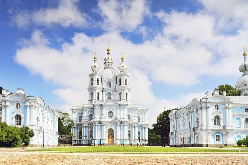
Smol'nyy Sobor on the map, Shushary, Russian Federation
Photo
Where is located Smol'nyy Sobor
Smol'nyy Sobor — local attraction, which is located at Ploshchad' Rastrelli, 1, St Petersburg, 191124 and belongs to the category — russian orthodox church. Average visitor rating for this place — 4.8 (according to 7881 rating, information from open sources and relevant for 2022).
Exact location — Smol'nyy Sobor, marked on the map with a red marker.
You can get directions to Smol'nyy Sobor on the map from your location.
What else is interesting in Shushary? You can see all the sights if you go to the city page.
Coordinates
Smol'nyy Sobor, Russian Federation coordinates in decimal format: latitude — 59.949088439911066, longitude — 30.395374298622325. When converted to degrees, minutes, seconds Smol'nyy Sobor has the following coordinates: 59°56′56.72 north latitude and 30°23′43.35 east longitude.
Nearby cities
The largest cities that are located nearby:
- Kolpino — 14 km
- Saint Petersburg — 15 km
- Pskov — 251 km
- Tartu
 (Estonia) — 265 km
 - Vantaa
 (Finland) — 299 km
 - Petrozavodsk — 300 km
- Helsinki (Finland) — 303 km
- Espoo (Finland) — 318 km
- Tallinn (Estonia) — 320 km
- Velikiye Luki — 383 km
- Tampere (Finland) — 397 km
- Cherepovets — 433 km
- Turku (Finland) — 449 km
- Tver — 467 km
- Navapolatsk
 (Belarus) — 488 km
 - Rīga
 (Latvia) — 494 km
 - Daugavpils (Latvia) — 496 km
- Rybinsk — 531 km
- Vologda — 542 km
Distance to the capital
Distance to the capital (Moscow) is about — 632 km.