
 Mikhaylovka
Dyrestuy
Mikhaylovka
Mayskiy
Novobessergenevka
Tersky District
Lesnoy
Tertezh
Kuz'minskiye Otverzhki
Mikhaylovka
Dyrestuy
Mikhaylovka
Mayskiy
Novobessergenevka
Tersky District
Lesnoy
Tertezh
Kuz'minskiye Otverzhki
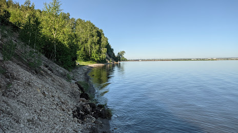
Yuzhnoural'skoye Vodokhranilishche on the map, Yuzhnouralsk, Russian Federation
Photo
Where is located Yuzhnoural'skoye Vodokhranilishche
Yuzhnoural'skoye Vodokhranilishche — local attraction, which is located at 17.2 km² and belongs to the category — -. Average visitor rating for this place — 4.0 (according to 76 ratings, information from open sources and relevant for 2022).
Exact location — Yuzhnoural'skoye Vodokhranilishche, marked on the map with a red marker.
You can get directions to Yuzhnoural'skoye Vodokhranilishche on the map from your location.
What else is interesting in Yuzhnouralsk? You can see all the sights if you go to the city page.
Coordinates
Yuzhnoural'skoye Vodokhranilishche, Russian Federation coordinates in decimal format: latitude — 54.49213433819061, longitude — 61.2329898516447. When converted to degrees, minutes, seconds Yuzhnoural'skoye Vodokhranilishche has the following coordinates: 54°29′31.68 north latitude and 61°13′58.76 east longitude.
Nearby cities
The largest cities that are located nearby:
- Chelyabinsk — 80 km
- Miass — 95 km
- Zlatoust — 128 km
- Magnitogorsk — 187 km
- Kostanay
 (Kazakhstan) — 208 km
 - Yekaterinburg — 267 km
- Kurgan — 280 km
- Pervouralsk — 284 km
- Ufa — 338 km
- Sterlitamak — 359 km
- Salavat — 371 km
- Tyumen — 394 km
- Orsk — 405 km
- Novotroitsk — 413 km
- Neftekamsk — 467 km
- Perm — 487 km
- Sarapul — 507 km
- Orenburg — 515 km
- Kokshetau (Kazakhstan) — 554 km
Distance to the capital
Distance to the capital (Moscow) is about — 1501 km.