
 Mikhaylovka
Dyrestuy
Mikhaylovka
Mayskiy
Novobessergenevka
Tersky District
Lesnoy
Tertezh
Kuz'minskiye Otverzhki
Mikhaylovka
Dyrestuy
Mikhaylovka
Mayskiy
Novobessergenevka
Tersky District
Lesnoy
Tertezh
Kuz'minskiye Otverzhki
CHesmenskaya kolonna on the map, Pavlovsk, Russian Federation
Photo
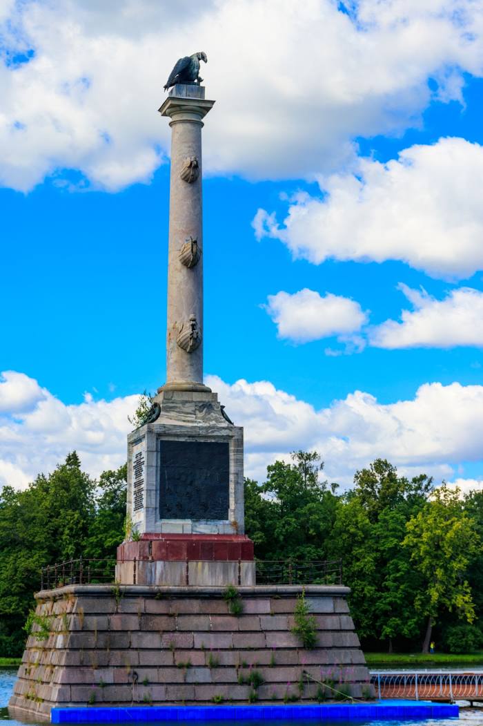
Where is located CHesmenskaya kolonna
CHesmenskaya kolonna — local attraction, which is located at Большой пруд, St Petersburg, 196603 and belongs to the category — tourist attraction. Average visitor rating for this place — 4.9 (according to 48 ratings, information from open sources and relevant for 2022).
Exact location — CHesmenskaya kolonna, marked on the map with a red marker.
You can get directions to CHesmenskaya kolonna on the map from your location.
What else is interesting in Pavlovsk? You can see all the sights if you go to the city page.
Coordinates
CHesmenskaya kolonna, Russian Federation coordinates in decimal format: latitude — 59.71014824883704, longitude — 30.393649898612697. When converted to degrees, minutes, seconds CHesmenskaya kolonna has the following coordinates: 59°42′36.53 north latitude and 30°23′37.14 east longitude.
Nearby cities
The largest cities that are located nearby:
- Kolpino — 10 km
- Saint Petersburg — 28 km
- Pskov — 241 km
- Tartu
 (Estonia) — 260 km
 - Vantaa
 (Finland) — 304 km
 - Helsinki (Finland) — 308 km
- Petrozavodsk — 308 km
- Tallinn (Estonia) — 321 km
- Espoo (Finland) — 324 km
- Velikiye Luki — 370 km
- Tampere (Finland) — 406 km
- Cherepovets — 428 km
- Turku (Finland) — 454 km
- Tver — 455 km
- Navapolatsk
 (Belarus) — 476 km
 - Daugavpils
 (Latvia) — 486 km
 - Rīga (Latvia) — 488 km
- Rybinsk — 523 km
- Vologda — 537 km
Distance to the capital
Distance to the capital (Moscow) is about — 614 km.