
 Mikhaylovka
Dyrestuy
Mikhaylovka
Mayskiy
Novobessergenevka
Tersky District
Lesnoy
Tertezh
Kuz'minskiye Otverzhki
Mikhaylovka
Dyrestuy
Mikhaylovka
Mayskiy
Novobessergenevka
Tersky District
Lesnoy
Tertezh
Kuz'minskiye Otverzhki
Muzej istorii goroda Uraj on the map, Uray, Russian Federation
Photo
Where is located Muzej istorii goroda Uraj
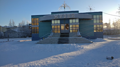
Muzej istorii goroda Uraj — local attraction, which is located at Ulitsa Mikrorayon.2, 39/1, Uray, Khanty-Mansi Autonomous Okrug, 628284 and belongs to the category — museum. Average visitor rating for this place — 4.5 (according to 54 ratings, information from open sources and relevant for 2022).
Exact location — Muzej istorii goroda Uraj, marked on the map with a red marker.
You can get directions to Muzej istorii goroda Uraj on the map from your location.
What else is interesting in Uray? You can see all the sights if you go to the city page.
Coordinates
Muzej istorii goroda Uraj, Russian Federation coordinates in decimal format: latitude — 60.129944750475595, longitude — 64.79321879862972. When converted to degrees, minutes, seconds Muzej istorii goroda Uraj has the following coordinates: 60°7′47.8 north latitude and 64°47′35.59 east longitude.
Nearby cities
The largest cities that are located nearby:
- Tyumen — 331 km
- Nefteyugansk — 430 km
- Yekaterinburg — 442 km
- Solikamsk — 452 km
- Berezniki — 457 km
- Pervouralsk — 459 km
- Surgut — 477 km
- Kurgan — 516 km
- Perm — 549 km
- Chelyabinsk — 588 km
- Zlatoust — 636 km
- Nizhnevartovsk — 638 km
- Miass — 640 km
- Ukhta — 665 km
- Glazov — 741 km
- Syktyvkar — 753 km
- Kostanay
 (Kazakhstan) — 767 km
 - Sarapul — 783 km
- Neftekamsk — 785 km
Distance to the capital
Distance to the capital (Moscow) is about — 1663 km.