
 Mikhaylovka
Dyrestuy
Mikhaylovka
Mayskiy
Novobessergenevka
Tersky District
Lesnoy
Tertezh
Kuz'minskiye Otverzhki
Mikhaylovka
Dyrestuy
Mikhaylovka
Mayskiy
Novobessergenevka
Tersky District
Lesnoy
Tertezh
Kuz'minskiye Otverzhki
Kotlasskiy Krayevedcheskiy Muzey on the map, Kotlas, Russian Federation
Photo
Where is located Kotlasskiy Krayevedcheskiy Muzey
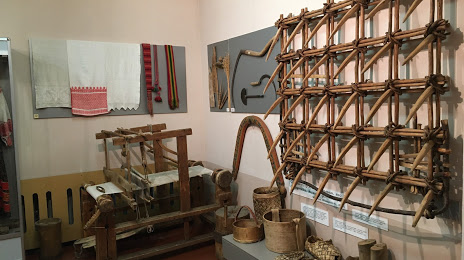
Kotlasskiy Krayevedcheskiy Muzey — local attraction, which is located at Ulitsa Vinogradova, 22, Kotlas, Arkhangelsk Oblast, 165300 and belongs to the category — museum. Average visitor rating for this place — 4.6 (according to 77 ratings, information from open sources and relevant for 2022).
Exact location — Kotlasskiy Krayevedcheskiy Muzey, marked on the map with a red marker.
You can get directions to Kotlasskiy Krayevedcheskiy Muzey on the map from your location.
What else is interesting in Kotlas? You can see all the sights if you go to the city page.
Coordinates
Kotlasskiy Krayevedcheskiy Muzey, Russian Federation coordinates in decimal format: latitude — 61.26080221149701, longitude — 46.628125998676. When converted to degrees, minutes, seconds Kotlasskiy Krayevedcheskiy Muzey has the following coordinates: 61°15′38.89 north latitude and 46°37′41.25 east longitude.
Nearby cities
The largest cities that are located nearby:
- Syktyvkar — 223 km
- Kirov — 340 km
- Ukhta — 431 km
- Vologda — 444 km
- Arkhangelsk — 466 km
- Severodvinsk — 489 km
- Glazov — 491 km
- Kostroma — 512 km
- Yoshkar-Ola — 515 km
- Cherepovets — 549 km
- Cheboksary — 565 km
- Yaroslavl — 567 km
- Novocheboksarsk — 571 km
- Rybinsk — 579 km
- Dzerzhinsk — 588 km
- Solikamsk — 591 km
- Berezniki — 604 km
- Zelenodolsk — 608 km
- Kazan — 623 km
Distance to the capital
Distance to the capital (Moscow) is about — 804 km.