
 Mikhaylovka
Dyrestuy
Mikhaylovka
Mayskiy
Novobessergenevka
Tersky District
Lesnoy
Tertezh
Kuz'minskiye Otverzhki
Mikhaylovka
Dyrestuy
Mikhaylovka
Mayskiy
Novobessergenevka
Tersky District
Lesnoy
Tertezh
Kuz'minskiye Otverzhki
Klintsovskiy Krayevedcheskiy Muzey on the map, Klintsy, Russian Federation
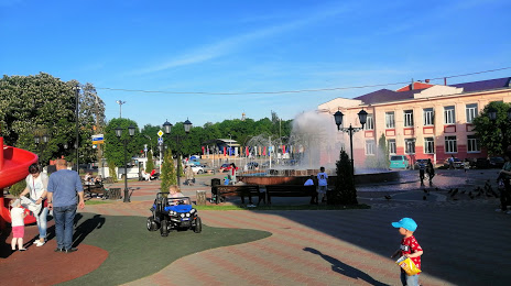
Photo
Where is located Klintsovskiy Krayevedcheskiy Muzey
Klintsovskiy Krayevedcheskiy Muzey — local attraction, which is located at Oktyabr'skaya Ulitsa, 45, Klintsy, Bryansk Oblast, 243100 and belongs to the category — museum. Average visitor rating for this place — 4.3 (according to 15 ratings, information from open sources and relevant for 2022).
Exact location — Klintsovskiy Krayevedcheskiy Muzey, marked on the map with a red marker.
You can get directions to Klintsovskiy Krayevedcheskiy Muzey on the map from your location.
What else is interesting in Klintsy? You can see all the sights if you go to the city page.
Coordinates
Klintsovskiy Krayevedcheskiy Muzey, Russian Federation coordinates in decimal format: latitude — 52.755528472107216, longitude — 32.23113689834119. When converted to degrees, minutes, seconds Klintsovskiy Krayevedcheskiy Muzey has the following coordinates: 52°45′19.9 north latitude and 32°13′52.09 east longitude.
Nearby cities
The largest cities that are located nearby:
- Gomel
 (Belarus) — 92 km
 - Bryansk — 153 km
- Chernihiv
 (Ukraine) — 154 km
 - Babruysk (Belarus) — 206 km
- Mazyr (Belarus) — 221 km
- Smolensk — 225 km
- Sumy (Ukraine) — 271 km
- Kyiv (Ukraine) — 283 km
- Kursk — 291 km
- Salihorsk (Belarus) — 316 km
- Kaluga — 326 km
- Minsk (Belarus) — 331 km
- Bila Tserkva (Ukraine) — 361 km
- Cherkasy (Ukraine) — 366 km
- Zhytomyr (Ukraine) — 376 km
- Obninsk — 379 km
- Tula — 382 km
- Navapolatsk (Belarus) — 383 km
- Belgorod — 387 km
Distance to the capital
Distance to the capital (Moscow) is about — 483 km.