
 Mikhaylovka
Dyrestuy
Mikhaylovka
Mayskiy
Novobessergenevka
Tersky District
Lesnoy
Tertezh
Kuz'minskiye Otverzhki
Mikhaylovka
Dyrestuy
Mikhaylovka
Mayskiy
Novobessergenevka
Tersky District
Lesnoy
Tertezh
Kuz'minskiye Otverzhki
Ozero Argayash on the map, Argayash, Russian Federation
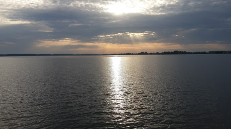
Photo
Where is located Ozero Argayash
Ozero Argayash — local attraction, which is located at no data and belongs to the category — -. Average visitor rating for this place — 4.1 (according to 8 ratings, information from open sources and relevant for 2022).
Exact location — Ozero Argayash, marked on the map with a red marker.
You can get directions to Ozero Argayash on the map from your location.
What else is interesting in Argayash? You can see all the sights if you go to the city page.
Coordinates
Ozero Argayash, Russian Federation coordinates in decimal format: latitude — 55.49030770204995, longitude — 60.918611002491154. When converted to degrees, minutes, seconds Ozero Argayash has the following coordinates: 55°29′25.11 north latitude and 60°55′7 east longitude.
Nearby cities
The largest cities that are located nearby:
- Chelyabinsk — 51 km
- Miass — 73 km
- Zlatoust — 84 km
- Yekaterinburg — 150 km
- Pervouralsk — 167 km
- Magnitogorsk — 261 km
- Kurgan — 281 km
- Kostanay
 (Kazakhstan) — 311 km
 - Ufa — 324 km
- Tyumen — 334 km
- Sterlitamak — 383 km
- Perm — 385 km
- Salavat — 402 km
- Neftekamsk — 412 km
- Sarapul — 445 km
- Izhevsk — 488 km
- Berezniki — 491 km
- Orsk — 501 km
- Novotroitsk — 506 km
Distance to the capital
Distance to the capital (Moscow) is about — 1457 km.