
 Mikhaylovka
Dyrestuy
Mikhaylovka
Mayskiy
Novobessergenevka
Tersky District
Lesnoy
Tertezh
Kuz'minskiye Otverzhki
Mikhaylovka
Dyrestuy
Mikhaylovka
Mayskiy
Novobessergenevka
Tersky District
Lesnoy
Tertezh
Kuz'minskiye Otverzhki
Desnogorskoye Vodokhranilishche on the map, Desnogorsk, Russian Federation
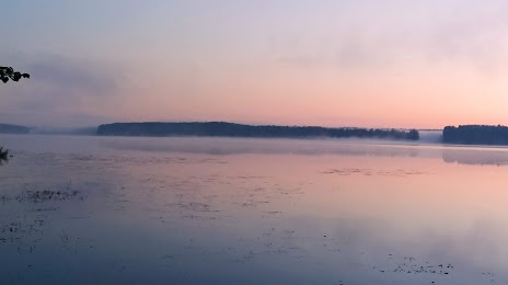
Photo
Where is located Desnogorskoye Vodokhranilishche
Desnogorskoye Vodokhranilishche — local attraction, which is located at 44 km² and belongs to the category — -. Average visitor rating for this place — 4.8 (according to 394 ratings, information from open sources and relevant for 2022).
Exact location — Desnogorskoye Vodokhranilishche, marked on the map with a red marker.
You can get directions to Desnogorskoye Vodokhranilishche on the map from your location.
What else is interesting in Desnogorsk? You can see all the sights if you go to the city page.
Coordinates
Desnogorskoye Vodokhranilishche, Russian Federation coordinates in decimal format: latitude — 54.23843140628356, longitude — 33.22984074270902. When converted to degrees, minutes, seconds Desnogorskoye Vodokhranilishche has the following coordinates: 54°14′18.35 north latitude and 33°13′47.43 east longitude.
Nearby cities
The largest cities that are located nearby:
- Smolensk — 106 km
- Bryansk — 123 km
- Kaluga — 197 km
- Obninsk — 235 km
- Gomel
 (Belarus) — 245 km
 - Serpukhov — 276 km
- Tula — 280 km
- Babruysk (Belarus) — 292 km
- Velikiye Luki — 295 km
- Odintsovo — 299 km
- Podolsk — 302 km
- Izmaylovo — 314 km
- Zelenograd — 316 km
- Khimki — 322 km
- Chernihiv
 (Ukraine) — 324 km
 - Novomoskovsk — 326 km
- Navapolatsk (Belarus) — 332 km
- Lyubertsy — 334 km
- Kursk — 334 km
Distance to the capital
Distance to the capital (Moscow) is about — 327 km.